I do not intend to pause, or rest, or rust. I will survive.
– Dr. George Sheehan |
Rocky Mountain National Park Region Trailheads |
We present the trailhead descriptions alphabetically by name. |
|
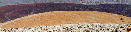
This 4WD trailhead is at 11,000 feet and provides access to the west sides of the peaks in the
central Never Summer Range such as Stratus, Nimbus and Cumulus. You can approach this trailhead from
Colorado 125 to the west or Colorado 14 to the north.
1. From Colorado 125, turn east onto Jackson County 21 and measure from this point.
This turn is 7.8 miles north of Willow Creek Pass, and 2.0 miles south of Rand.
Go east on Jackson County 21, and continue straight on FR 740 at mile 0.6.
Enter Routt National Forest at mile 4.2, bear north (left) at mile 5.0,
cross to the north side of Jack Creek (signed) at mile 7.0, turn east (right) at mile 7.1,
and reach the junction of FR 740 and FR 758 in the historic townsite of Teller City at mile 9.5.
2. From milepost 55.4 on Colorado 14, turn south onto FR 740 at the small town of Gould
and measure from this point. Gould is 9.2 miles west of Cameron Pass and 21.5 miles southeast of Walden.
Go south through Gould on the main road and enter the Routt National Forest on what is now FR 740 at mile 0.7.
Pass the Pine Campground at mile 3.1, pass the Silver Creek Road (FR 780), which heads east, at mile 3.9
and reach a big 3-way junction at mile 4.7. Take the westernmost (rightmost) of the three roads which is the
continuation of FR 740. This road is signed for Teller City, not Jack Creek. Continue south of FR 740,
cross the broad Calamity Pass and reach the junction of FR 740 and FR 758 in the historic townsite of
Teller City at mile 8.5.
FR 740 is dirt, but is passable by 2WD vehicles. The road from Teller City to the Jack Creek Trailhead
requires a 4WD vehicle. From the junction of FR 740 and FR 758 in the historic townsite of
Teller City, go east onto FR 758 and measure anew from this point. Pass several good campsites
south of the road at mile 0.3, pass another good campsite south of the road at mile 1.8
and reach the junction of the upper Jack Creek Road (signed for Baker Pass) and Jack Park Road at mile 3.2.
Go straight east uphill at this junction on a now rougher road (FR 758). Pass a dilapidated cabin at mile 3.4,
pass another good campsite south of the road at mile 3.8, bear north (left) at mile 3.9, switchback twice
and reach a large log that once blocked the road at mile 4.9. Go above the log and continue on the
nearly level road to mile 5.8 where the road starts to climb the hill to the north.
Climb steeply via a series of sweeping turns, pass a good campsite en route
and reach the end of the road and the signed Jack Creek Trailhead at mile 6.4.
The total distance from Colorado 125 to the trailhead is 15.9 miles,
and the total distance from Colorado 14 to the trailhead is 14.9 miles.
The last few miles of this bumpy 4WD road require slow driving,
and the approach from pavement to the trailhead can take more than an hour.
|
|
This trailhead is at 7,700 feet and provides access to the North Inlet Trail,
which reaches the peaks in the northeast Mummy Range, and the Bulwark Ridge Trail,
which reaches the Signal Peaks. From the town of Glen Haven northeast of Estes Park,
wind 2.1 miles east along the North Fork of the Big Thompson, turn northwest (left)
onto the Dunraven Glade Road, and go 2.2 miles northwest to the well-marked trailhead.
There are two trails that start at this trailhead, so make sure that you get on the
one you want.
|
|
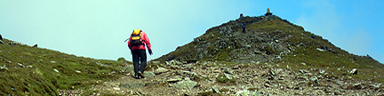
This trailhead is at 9,400 feet and provides access to the north side of Seven
Utes Mountain. If you are approaching from the east, go 3.9 miles west from the
summit of Cameron Pass on Colorado 14. If you are approaching from the west,
go 5.6 miles east from Gould on Colorado 14. Turn south onto a dirt road and go
south for 200 yards to the trailhead. In winter, park closer to the highway.
|
|
| This trailhead is at 9,600 feet and provides access to the west side of Radial Mountain.
The trailhead is at a parking area on the east side of Colorado 125 just 150 yards
south of the summit of Willow Creek Pass. The parking area is plowed in winter. |