Och! The Coolin! That’ll stand no foolin’!
The rocks at the bottom are terrible hard.
The summit’s fine and airy, and the slopes contrary
Exhaust the vocabulary of an Irish bard.
– English Rucksack Club song - 1922 |
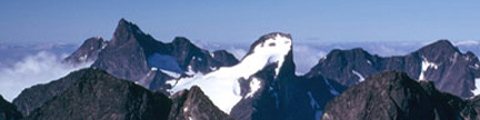
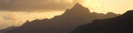
“Island Lake Peak” 12,220 feet
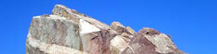
This overlooked, unofficially named peak is the Rawah’s roughest peak. Rugged on all sides,
it sits on the Rawah range crest between Island Lake to the east and Kelly Lake to the west. |
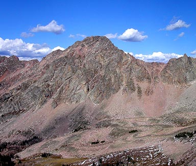 |
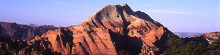
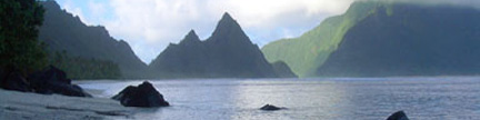
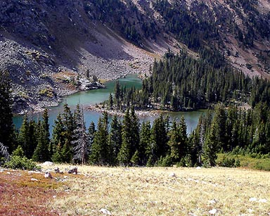
The west face of “Island Lake Peak” seen from the east slopes of Point 11,667 to the southwest |
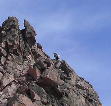 |
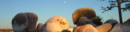
Sheep posing on the southeast ridge of “Island Lake Peak” |
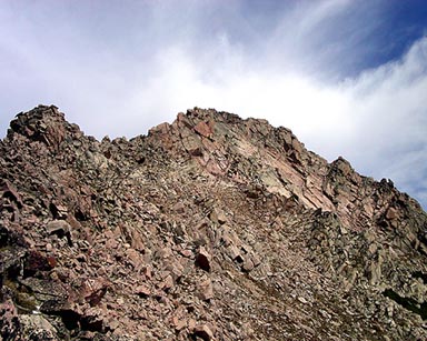 |
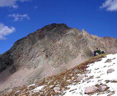
The route on the east side of the south ridge
Cross back to the ridge’s west side to the left of the blocky tower in the center |
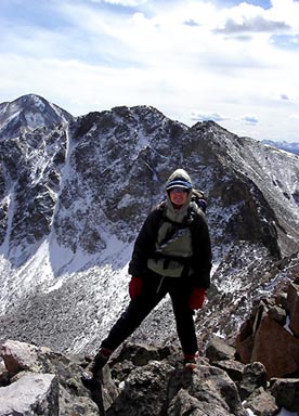 |
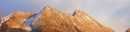
Jennifer arriving at the summit of “Island Lake Peak”
Point 12,380 aka “Puma Peak” is behind in the center,
and Clark Peak is in the distance on the left |
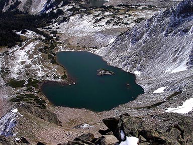 |
Island Lake from the summit |
 |
The north end of Kelly Lake |
 |
Jack Dais enjoying Colorado after the climb |
| Gerry took the above photos on 9/20/03 |
USGS 7.5’ Quadrangles: Rawah Lakes, Clark Peak
South Ridge –
From 2WD TH: 10.2 miles RT, 2,660 feet net, 4,020 feet total, Class 2+
From 4WD TH: 7.2 miles RT, 1,850 feet net, 3,210 feet total, Class 2+ |
| This is the most expedient route on “Island Lake Peak” for a one-day ascent.
Start at the Ruby Jewel Trailhead
at 9,560 feet, and go 1.5 miles west up the steep, rough 4WD road to the
4WD parking area at the end of the road at 10,370 feet.
The Jewel Lake Trail starts at the parking area’s north side.
Follow the trail north for 0.5 mile toward Jewel Lake,
turn west at a signed trail junction onto the
Kelly Lake Trail and follow this trail 0.2 mile west up to a saddle at 10,860
feet. Descend 0.4 mile north-northwest on the trail to reach the North Fork
of the Canadian River at 10,400 feet. Climb north on the dwindling trail for
1.5 miles to the 11,220-foot saddle between Point 11,667 to the west and Point
12,380 to the east. From this saddle, you can see Kelly Lake to the north
and the imposing “Island Lake Peak” to the northeast. Contour 0.3 mile northeast
and descend slightly on the continuing trail to a grassy bench at 11,100 feet.
Your 2.9 mile, Class 1 trail approach is over. |
| Leave the comfort of the trail, and hike 0.2 mile east across large, loose
talus blocks to the wild basin below the southwest side of “Island Lake Peak” and
the northwest side of Point 12,380. Climb east up the northernmost of two
scree gullies to reach the ridge between these two points at 11,820 feet.
This small saddle is just north of the 11,780-foot low point between “Island Lake Peak”
and Point 12,380. From the ridge, you can see Island Lake below you
to the east. Cross to the east side of the south ridge of “Island Lake Peak”, and
climb north up blocky ledges to a point on the south ridge at 12,000 feet
just below a steeper tower above (see photo). Cross back to the ridge’s west
side, contour north below the steep tower, then climb east to regain the ridge
above the tower. From here, you can finally see the summit, which is the farthest
ridge point to the north. Hike north along the now easy ridge until another steep tower blocks your swift progress.
Descend 100 feet down the east side of the ridge, then climb north along and up blocky ledges to bypass the second tower.
Climb west back up to the ridge beyond this obstacle, and continue north to the highest point.
If you take care to find the easiest route, the difficulty will not exceed Class 2+, but harder,
looser climbing is never far away on this obtuse route. |