|
|
|
|
|
|
|
|
|
|
|
|
|
|
|
|
|
|
 |
 |
|
|
 |
|
|
There is a gap between man’s powers to conceive and his ability to achieve that can be bridged only by desire. |
|
Dos Cabezas
|
|
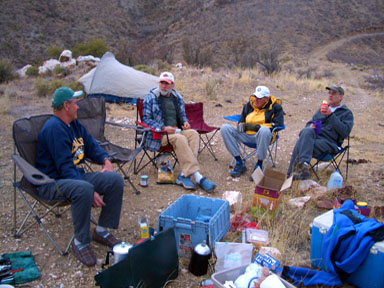 |
The senior staff discussing route options at the 4WD camping place L-R: Jack Dais, Gerry Roach, Earl Voight, Dave Anschicks |
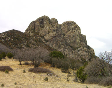 |
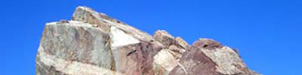
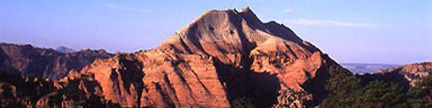
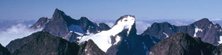
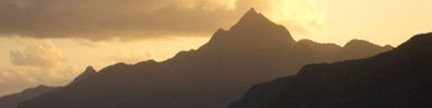
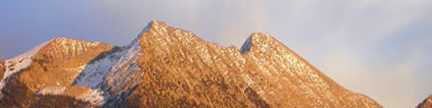
Dos Cabezas from the southeast The South Peak is on the left |
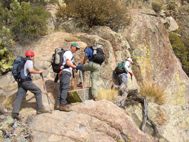 |
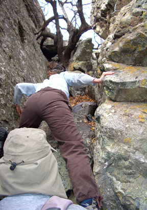
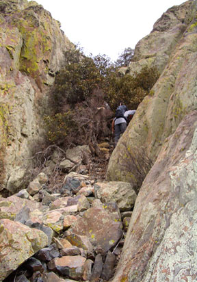
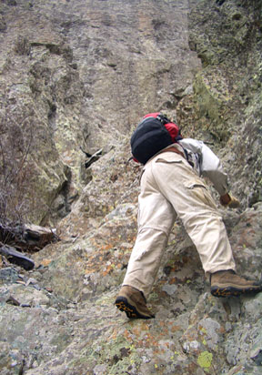
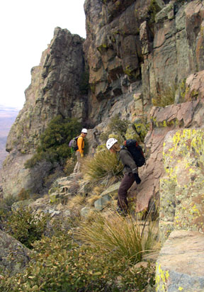
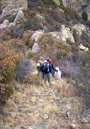
Starting the traverse across the South Peak’s lower east face to reach the gully between the South and North Peaks |
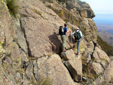 |
Traversing across the South Peak’s lower east face to reach the gully between the South and North Peaks |
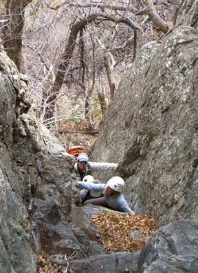 |
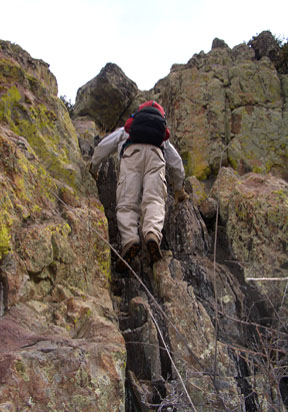
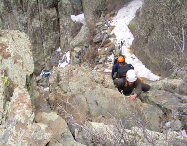
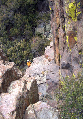
Debbie Hruza making the Class 4 move in the east-facing gully between the South and North Peaks |
 |
Debbie Hruza making the Class 4 move in the east-facing gully between the South and North Peaks |
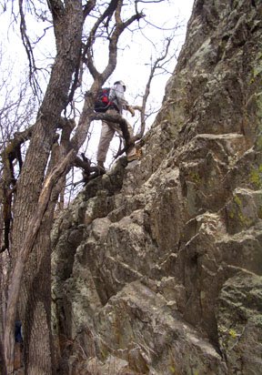 |
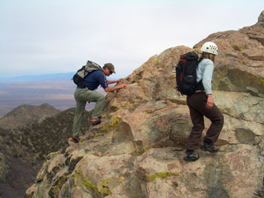
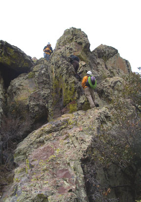
Gerry starting up the North Peak’s standard route This start is near a tree a few strides west of the saddle between the South and North Peaks |
 |
An alternate start to the North Peak’s standard route This start is around the corner to the west from the previous photo |
 |
Gerry scrambling up a Class 3 section on the North Peak’s standard route |
 |
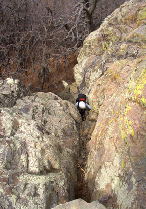
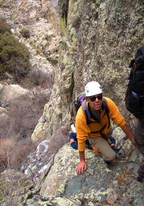
In the key gully on the North Peak’s standard route |
 |
Dave Anschicks and Debbie Hruza enjoying joyous scampering near the top of the North Peak |
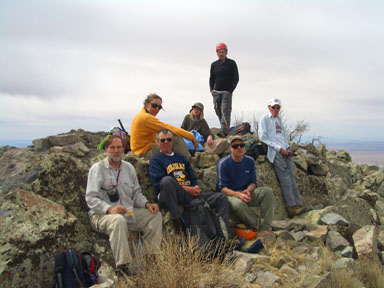 |
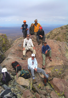
On top of the North Peak No task too tough for this team! L-R: Gerry Roach, Mike Hruza, Jack Dais, Debbie Hruza, Dave Goldwater (standing), Dave Anschicks, Earl Voight Photo by Jennifer Roach |
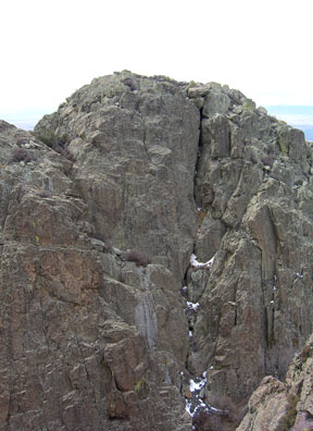 |
The north face of the South Peak as seen from near the top of the North Peak The route starts up the central gully then climbs up to the west (right) of the gully |
 |
Gerry starting up the gully on the north face of the South Peak |
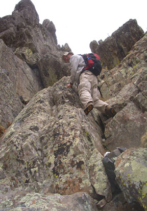 |
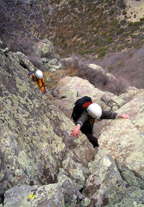
Gerry starting the Class 3 scrambling west of the gully on the north face of the South Peak |
 |
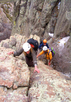
Mike Hruza on the Class 3 scrambling west of the gully on the north face of the South Peak |
 |
Debbie Hruza on the Class 3 scrambling west of the gully on the north face of the South Peak |
 |
Debbie Hruza on the Class 4 crux west of the gully on the north face of the South Peak |
 |
Mike and Debbie Hruza on the Class 3 scrambling near the top of the South Peak |
 |
The triumphant team on top of the South Peak |
 |
Cabezart |
 |
Starting the descent down the south face of the South Peak |
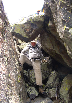 |
Gerry descending under the chockstone that is near the top of the upper gully on the south face of the South Peak |
 |
Mike and Debbie near the blind corner on the south face of the South Peak |
 |
The hidden passage between the approach gully and the traverse to the blind corner |
 |
Return to the bushes! |
| Gerry and Jennifer took the above photos on 3/27/06. | |
USGS 7.5’ Quadrangle: Dos CabezasIntroduction |
| The North Peak carries the given elevation of 8,354 feet on the USGS quadrangle, but the South Peak does not have a given elevation. Careful handlevel measurements by many people have concluded that the South Peak is three feet higher than the North Peak, hence this report uses 8,357 feet for the elevation of the South Peak. The South Peak has 3,247 feet of prominence and is the 19th most prominent peak in Arizona. |
| There are multiple routes and variations on these two summits. The easiest route on the North Peak (Class 3) is on its upper southwest face, which rises above the saddle between the two peaks. You can reach this saddle from either the west or the east. The eastern gully has a Class 4 step in it; the western approach to the saddle is easier, but requires a long bushwhack. The easiest route on the South Peak (Class 3) is a hard-to-see line on its south face. The ascent of both peaks requires ascending or descending the north face of the South Peak (Class 4), and there are arguments for doing the traverse in either direction. If you climb the North Peak first, you can then upclimb the Class 4 crux. If you climb the South Peak first, you can protect your downclimb with a rope or even rappel over this crux. |
Approach |
| Start at the Mascot Canyon Trailhead northeast of the small town of Dos Cabezas, Arizona. The continuing road up Mascot Canyon is gated 0.5 mile beyond the trailhead, and this is not the route. Leave the canyon road, follow a 4WD road northwest then west up a steep hill, pass an old mine, and continue west up the 4WD road to a small saddle at 6,260 feet. Leave the 4WD road at the 6,260-foot saddle, and hike 0.3 mile north up a steep hill to a ridge at 6,800 feet. Follow this ridge 0.9 mile northwest to some large towers at 7,900 feet. Go around the tower site and descend slightly to some open meadows northwest of the towers. From here, you will have a clear view of Dos Cabezas, and the introduction is over. |
South Peak – South Face – From Mascot Canyon TH – 4.8 miles RT, 2,657 feet net & total, Class 3 |
| This is the easiest route on the South Peak. It is a moderate hike followed by hard-to-find, but rewarding Class 3 scrambling. Follow the approach to the meadows just west of the towers. |
| From the meadows, study the south face of the South Peak carefully, since the route is not obvious. The route starts in a large, brushy gully on the lower west (left) of the face, does an ascending traverse up to the east (right) across the face, goes east (right) around a blind corner, ascends a brushy gully high on the east (right) side of the face to the vicinity of a small notch to the east of the South Peak. Launch when ready. |
| From the meadows, bushwhack 0.3 mile northwest up the continuing ridge and get into the large, brushy gully on the lower, west side of the face. Ascend this gully to 8,120 feet, passing a colorful wall on the gully’s east (right) side. Look sharp to the east, find and follow an easy, stepped passage up the rocks on the gully’s east side above the colorful wall. This is the beginning of the Class 3 scrambling. Follow a use trail through the bushes up to the east (right), then scramble up another stepped passage to the east. Follow a broad, but narrowing ledge up to the east (right), go east around a blind corner, and traverse east into the major gully system on the upper, east side of the south face. Follow a use trail up through the bushes in this narrowing gully. As you approach the top of the gully, scramble under a 6-foot chockstone. Thirty feet above the chockstone, just below a small notch east of the summit, turn west (left) and scramble up a key passage. Above this, scamper west to the highest point. |
North Peak – Southwest Face – From Mascot Canyon TH – 5.0 miles RT, 2,654 feet net & total, Class 4 |
| This is the most expedient route on the North Peak. There is one Class 4 move in the approach gully, but the rest of the route is Class 3 or easier. Follow the approach to the meadows just west of the towers. The South Peak dominates the view from here, but you can also see much of the North Peak. The route reaches the saddle between the two peaks from the east. Most of the gully below this saddle is hidden in your meadow view. |
| From the meadows, go 0.25 mile northwest on the ridge toward the South Peak. Leave the ridge at 8,050 feet, descend on the north side of the ridge and contour north at the 7,900-foot level. This traverse is steep, rocky and brushy. Climb onto the rocks on the South Peak’s lower east face. Do an ascending traverse to the north following the path of least resistance to reach the major gully between the South and North Peaks (Class 3). If you find yourself doing hard climbing on this approach traverse, look around for an easier way. |
| Once in the major gully, scamper west up it to the base of a narrow passage on the gully’s south (left) side. Climb an awkward, Class 4 move to bypass the narrowest spot, then scamper on up to the saddle between the South and North Peaks. Go all the way into the saddle. Hike 50 feet down onto the west side of the saddle to the base of a broken, stepped, south-facing passage near a tree. This is the beginning of the route up the upper North Peak. |
| Scramble 40 feet up the initial Class 3 passage, trending west (left) en route, to reach lower-angled terrain. From here you can see much of the rest of the route. Scramble north following the path of least resistance to reach a brushy, 30-foot wide gully on the North Peak’s upper southwest face. Scamper up this gully, utilizing a use trail through the worst bushes, to reach a small notch at the top of the gully. Turn east (right) and scramble up one of several available Class 3 passages to reach another small notch. From here scamper gleefully east up to the highest point. |
Variations: |
|
North Peak to South Peak Traverse – From Mascot Canyon TH – |
| This is the big one. Climb the Southwest Face Route on the North Peak and preview the north face of the South Peak from this strategic vantage. Return to the saddle, hike south above the saddle, and enter the large, central gully on the South Peak’s North Face. Scramble up or just to the right of the center of the gully for 80 feet. As the gully fades into the face above, trend west (right) and continue your steep, Class 3 scrambling for another 100 feet. Climb an exposed, Class 4 slab which is the route’s crux. Above the crux, scramble southwest, then southeast to the highest point of the South Peak (Class 3). The scrambling on this north face is more serious than the south side routes on either peak, and snow can linger here to complicate your ascent. Descend the South Peak’s South Face Route. |
Copyright © 2001-2023 by Gerry Roach. All Rights Reserved. |