People always call it luck when you’ve acted more sensibly than they have.
– Anne Tyler |
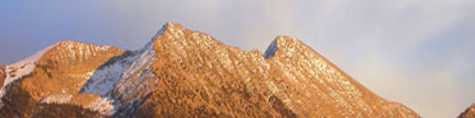
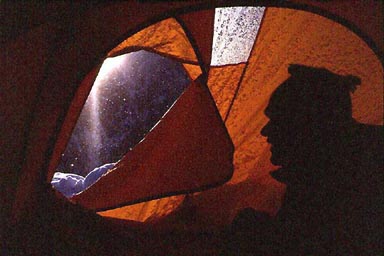
East Kahiltna Peak, May, 2001 |
| It was the middle of the Alaska night
when our taxi groaned to a stop in front of the Earth B&B in Anchorage.
A tall, stately woman greeted us and directed us to the back with our bags.
Soon, we were in a tidy room. The Earth B&B was the first of many pleasant
surprises on this Alaska trip. In the morning, the kitchen filled with eager
climbers en route to several different destinations ranging from Logan to
Denali. The Earth B&B proprietor, Margriet van Laake, and her partner
Bill Merchant regaled us with coffee, bagels and stories. |
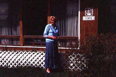 |
Margriet van Laake in front of the Earth B&B in downtown Anchorage |
| After picking up our fuel cartridges at REI, attending to other chores and grabbing a quick
halibut burger at Humpy’s, it was off to Talkeetna. After the obligatory beers
at the Fairview Inn and a sleep, it was take-off time for the rush toward Kahiltna
International. As always, the Great Land grabbed my soul like a cosmic cry. |
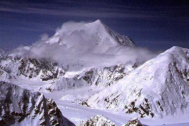
 |
Foraker as seen through One-Shot Pass |
| One-Shot Pass skimmed under the wings as Foraker loomed ahead. I was here in part to reflect on my previous
ascents. I first climbed Denali in 1963, and wooed by her beauty, I vowed to climb Foraker on that trip,
a promise I kept in 1975. Then, the Cessna raced past Mount Hunter’s West Ridge
that I climbed in 1994. Then, boom, there was the Great One. |
 |
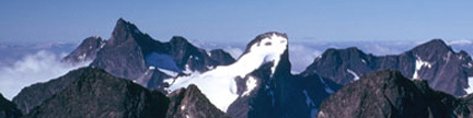
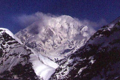
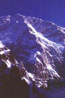
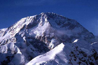
Denali as seen from near Hunter’s West Ridge
East Kahiltna Peak is just in front of the Great One |
| We were coming in high and hot to get
a view of the route, the south ridge of East Kahiltna Peak. At 13,440 feet,
East Kahiltna Peak is the fourth highest peak in Denali National Park. The goals
of this trip were to climb the fourth highest and bask in the views of the
other three. East Kahiltna Peak is just southwest of Denali, and is located
in the middle of the big three. For me, I was heading into the center of the universe. |
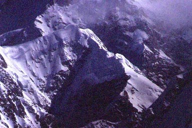 |
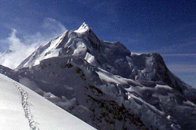
East Kahiltna’s south ridge is the sun-shadow ridge right of center
Denali looms behind during our aerial reconnaissance |
| The Cessna buzzed the bottom of the
route, and it looked deceptively simple from the air. There was one great
crack in the ridge up high, and the pilot went farther up the East Fork to look for a way around it. After spotting an end run on the right,
the plane zoomed back to Kahiltna Base. I first landed at this site
with Don Sheldon in 1963 when we threw pine boughs out the window of Don’s
Super Cub to mark the runway. Before we could land in ’63, we had to toss
half our gear out the window as well to lighten the plane. In 1963, we had
the Southeast Fork of the Kahiltna Glacier and most of Denali to ourselves.
In 2001, the runway was marked with numerous orange sleds stuck vertically
in the snow. Our landing in the super-charged Cessna was like giving candy
to a baby; it was smooth as soy milk. The plane taxied up to more sleds, which were the
“gates.” Each gate was marked with the initials for a different air service.
There were five gates. After meeting Lisa, the basecamp manager, I marveled at
the tent city before me. There must have been more than 100 people in basecamp.
How times change! I feel privileged to have seen this pristine place with
Don Sheldon in 1963. I could also see the peak and route to the northeast
through the notch between Mt. Francis and Denali’s South Buttress. |
 |
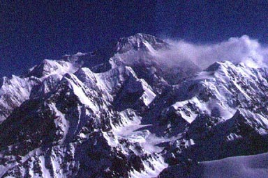
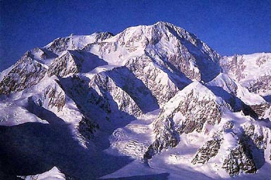
East Kahiltna Peak and Denali as seen from Kahiltna Base
The south ridge is the sun-shadow ridge in the center of the photograph |
| By noon, I was enjoying the first glorious downhill mile to the main Kahiltna
Glacier. After marching up the snow highway on the Kahiltna Glacier
that everyone uses en route to Denali’s West Buttress, I left
this main route, turned toward the East Fork and took the path less traveled. |
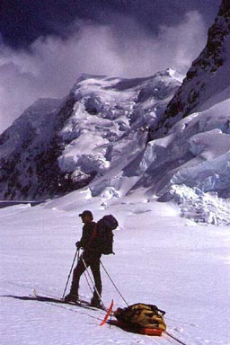 |
The path less traveled |
| My excitement rose as I pulled away
from the path of least resistance, and entered the sanctuary of a glacier
valley where I had never been before. The reality of the steepening
uphill grade, the deceptive distance and the long day wore on me. After pitching
basecamp in the evening, the views and silence were already
sufficient reward. In the morning, I examined the privileged position in the middle
of the East Fork between Denali’s South Buttress and East
Kahiltna Peak. The south ridge was directly above to the north, and it
looked more serious than it had from the air. |
 |
East Kahiltna Peak as seen from the East Fork basecamp |
| To my surprise, I also had a stunning view of the Cassin Ridge on Denali.
This is North America’s finest mountaineering line, and it showed me why. |
 |
The Cassin Ridge on Denali as seen from the East Fork basecamp |
| I spent the day organizing gear and resting. During a snooze in the tent, I heard a load roar.
I wondered if this was something that I needed to pay attention to, but after unzipping
the tent for a view, I had my answer. I scrambled from the tent, stood,
turned and faced a huge cloud racing toward me. As I ran past the tent,
I grabbed my boots and ice ax and trotted uphill while snatching glances back at
the approaching monster. It looked more and more like I would just get dusted,
but you never know. Still in my down booties, I paused 50 yards from the
tent as the cloud rolled over me. The sun disappeared as the fine ice dust
covered my turned back, leaving me white. Back in camp,
I kicked myself for not zipping up the tent before fleeing. There was
a half-inch of ice dust on the tent. When the cloud cleared, I saw
that the nearest debris was far from camp near the base of the face. Nevertheless,
I dubbed basecamp, “Camp Hazard.” |
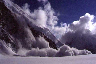 |
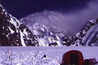
One of several slides that dusted the East Fork |
| In the late afternoon, I did a recon over to the base of our 4,400-foot high route, weaving to solve the crevasses between camp and the start of the steep climbing.
The next morning’s sun warmed steady steps above Camp Hazard onto
the initial slope leading to the crest of the south ridge. On the ridge I
expected to find a flat crest for a commodious camp. Ha! The ridge was knife-edged
and after casting about in dismay, spent several hours digging a platform for my large
tent. I pitched the tent with great care to avoid dropping a tent pole. Inches
from the edge of the tent, the snows fell away at dizzy angles. I had talked
about bringing a small tent for tight spots like this, but this climb was
supposed to be easy. What on Earth was I thinking? A steep peak right under
the Cassin Ridge easy? Not likely. I had flown in with four ice screws, but
after the deceptive view from the airplane, left two of them in basecamp.
Now, I had to use one of the two remaining screws to anchor the tent. However,
once set, this comfy camp with a view quickly became known as, “the Perch.” |
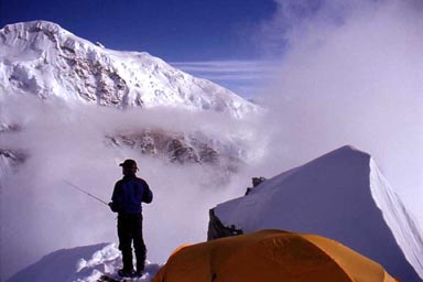 |
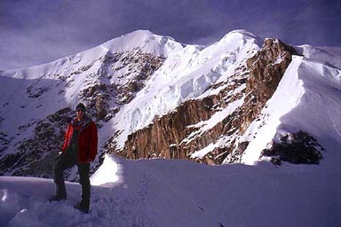
Perching |
| On May 19th, I stirred at 6AM to begin summit day.
I spent some time fiddling with a makeshift, but light pack. To further save
weight, I decided to take only one camera and leave the case behind. A few
hundred yards above camp, I met the challenge on an icy traverse. |
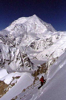 |
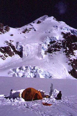
Foraker soars above the Kahiltna Glacier and the Perch |
| After some initial steepness, the angle moderated, and engrossed in the effort,
I found my head, which had been screwed on sideways up to this point. Anymore,
I seem to spend more time lamenting the fact that I am getting too old for
this steep stuff, but if I concentrate on climbing instead of complaining,
age doesn’t matter. |
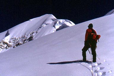 |
Gerry leading toward the still distant summit |
| The route rolled up, over and around slopes punctuated with nifty knife-edged ridges. I felt like I
was climbing a high altitude roller coaster, and cruised over these delightful
obstacles in stride until there was no longer any sign of that easy route I had spotted from the Cessna. |
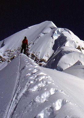 |
The upper peak looms
You can see the route’s crux, a big crack in the ridge |
| In the saddle below the upper loom, I stopped for a break and brewed up.
After earlier low-water ascents on Hunter, King Peak and St. Elias,
I had taken the precaution of bringing a small stove on summit day. This turned out to be one of
my better moves, and the extra water was a great help. Refreshed, I tackled a steep
slope that quickly turned into one of the
route’s cruxes. In an effort to end-run some air-filled snow, I traversed
right only to find more crummy snow over ice, with a crevasse running through
it. After scraping up this unexpected obstacle, I moved on up to the
expected crux, the big crack in the ridge. |
| The expected end-run on the right held four inches of foofy
snow over hard Alaska Blue. For those that don’t know, that’s ice so hard
that you can barely nick it with an ice ax. With only one ice screw, I was woefully
under equipped to tackle this slope. I needed the four screws that I flew in with.
With the end-run cut off, I now peered up a widening, vertical ice cliff.
The slope under the ice cliff ended in a huge crevasse. |
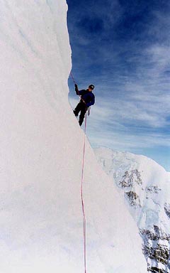
| A rope-length higher, I spotted an improbable semi-ramp with vertical ice below and above. |
| After leaving the pack and camera, a few anxious minutes later
I balanced at the end of the semi-ramp, reached around the corner and
placed a tool. Expecting Alaska Blue, hoping for something softer, the tool
went chunk, and stuck! I rocketed up the slope above the ice wall. |
| Thus, poised high and above two cruxes, with one picket and one screw,
I started for the summit with the shirt on my back. It was pure. |
| The summit ridge was beyond pure. It was an Alaska Classic. Climbers in the French Alps would turn triple
flips to find a ridge like this. Unlike the crowded Alps however, I had this
privileged position to myself. |
| The peak’s east and west
ridges converged above, and I stomped up to the apex of these ridges and
the south ridge. The summit. I had expected the summit to be a dome, but
it was little more than a point. The view was beyond my already grand expectations.
To the north, Denali filled half the horizon. I peered down into the depths
of the Kahiltna’s Northeast Fork, across and up at the famous West Rib Route. |
| I studied the Cassin Ridge carefully and photographed its details with my mind.
I have no dispersions of climbing this route. |
| Looking northwest, I saw the tundra. In this world of snow and ice, I had forgotten
about things green. The view twanged my heartstrings. I have had a long relationship
with this great range, and have spent many days on the tundra north of the
great peaks. I had already invested much of my soul in climbing both Denali
and Foraker from Wonder Lake in the tundra north of the peaks. Like all views
Alaskan, this one was hard to grasp. That’s why they call it the Great Land. |
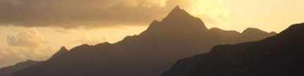
| Turning my back on Denali, the view opened to the southwest, where Foraker flew above it all. More than
Denali’s queen, it really is the perfect peak. Alone and aloof, Foraker’s
summit is a point few reach. Turning again, there was Hunter, Denali’s child.
I had proclaimed this summit beyond me for most of my climbing career, then
climbed the mountain in 1994. |
| As I spun round, the great peaks surrounded me. This is what I had come for. I was indeed in the center
of Denali’s universe. Denali is the starting point for the great backbone
of mountains that support the Western Hemisphere, and I consider the
summit of East Kahiltna Peak to be Earth’s fulcrum. I stomped a huge “HI”
in the snow. It was my summit register. Perhaps some climber on the West
Buttress saw it and pondered the fact that there is more. |
| The lack of a camera was a technical annoyance. However, I saw more keenly without
it. I had to impregnate the view on my brain forever. Perhaps, the following photos can help others. |
 |
Mount Hunter as seen from near the summit of East Kahiltna Peak |
 |
Mount Foraker as seen from near the summit of East Kahiltna Peak |
 |
The south side of Denali
East Kahiltna Peak is in the lower left |
 |
The grandeur surrounding Earth’s fulcrum |
| If I was not human, I could stay on the summit forever. Alas, I descended. |
 |
Descending the semi-ramp |
| Back at the Perch after an 11-hour climb, I was not tired, and spent
hours enjoying the long Alaskan evening. There was no room to strut, so I
just perched. The rest of the world would return soon enough. For now, I was free. |
 |
Gerry at the Perch after the summit climb |
 |
Freedom |