When you’re through changing, you’re through.
– Bruce Barton |
Trailheads for New Mexico’s Classic Peaks |
| We present the trailhead descriptions alphabetically by name. |
|
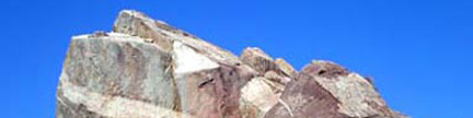
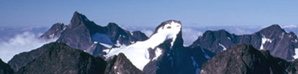
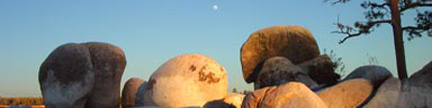
| This trailhead is at 6,480 feet, and provides access to all sides of Cabezon Peak.
If approaching from the south, go 42 miles northwest on U.S. 550 from Exit 242 on Interstate 25
in the town of Bernalillo. If approaching from the north, go 21 miles southeast on U.S. 550 from
the town of Cuba. Turn west onto Sandoval County Road 279 (CR 279), and measure from this point.
Go west, then southwest to the end of the pavement at mile 8.7, continue southwest on CR 279,
and turn south (left) onto BLM 1114 at mile 12.6. Go south on BLM 1114, and turn east (left)
onto the Cabezon road at mile 15.5. This junction has a large sign explaining Cabezon Peak,
and you can easily see Cabezon Peak to the east. Go east on the Cabezon road, and reach the end
of the road and the signed trailhead at mile 16.4. In dry weather, the roads leading to this trailhead
are passable to most vehicles. The roads can get slippery and rutted in spring, and this trailhead
can be unreachable in winter. |
|
| This trailhead is at 5,340 feet, and provides access to the east side of Cookes Peak.
If you are approaching from the south, leave Interstate 10 at Exit 82 in Deming. Go 1.3 miles north on
U.S. 180, turn northeast onto N.M. 26, and go 14.4 miles to the Cookes Canyon Road. If you are
approaching from the north, leave Interstate 25 at Exit 41, cross the Rio Grande River, go through
Hatch, get onto N.M. 26, and go 32.3 miles southwest to the Cookes Canyon Road. The Cookes Canyon Road is
between mileposts 14 and 15 on N.M. 26, there is an old farm house north of the road, a water tank
south of the road, and the Cookes Canyon Road has a sign denoting it as Luna County A019. |
| Turn onto the Cookes Canyon Road and measure from this point. Go northwest on the Cookes Canyon
Road, and continue straight at mile 5.1 where another road goes southwest (left) to the Hyatt Ranch.
Reach the 2WD trailhead at mile 11.0 at a locked Hyatt Ranch gate. There are old Cottonwoods here,
ranch buildings, and a cattle station. The graded, gravel road is good to this point. |
| The BLM has negotiated an easement around this private land. If you choose to continue on foot,
follow orange stakes west of the road. The Hyatt Ranch cannot deny a request to cross this land
to access the BLM land just beyond, so if you call the ranch at 505-546-9694, they will give you the
combination to the lock. If you have secured permission and choose to continue with a 4WD vehicle,
pass through the gate, turn west (left) to get out of the cattle yard, then continue northwest on the
much worse road where you will soon reach BLM land. Pass a windmill and water tank at mile 12.3 where
there are places to camp, but if you do stop here, please camp at least 300 feet from any water source.
Continue northwest on the road, stay left at mile 12.8, and reach the 4WD parking spot at mile 13.2.
Campsites here are rudimentary. |
| It is 2.2 miles from the locked ranch gate to the 4WD parking spot at 6,040 feet where a
small BLM sign advises that the old road heading toward the peak is not passable to vehicles.
Heed this advice. From the 4WD parking spot, you have an unobstructed view of Cookes Peak’s
imposing east face. The old Cooks Peak townsite is 0.8 mile beyond the 4WD parking spot. |
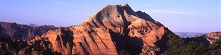
Modoc Trailhead |
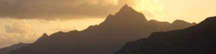
| This trailhead is at 5,300 feet, and provides access to the west side of Organ Needle.
Measure from the University Avenue Exit (Exit 1) on Interstate 25 in the town of Las Cruces
in southern New Mexico, and go east toward the Organ Mountains. Curve around the north side
of a small mountain that holds electronic equipment and a prominent “A”
on what becomes Dripping Springs Road. Go straight at a junction with Soledad Canyon Road
at mile 4.9, cross a cattle guard at mile 6.1, and turn north (left) onto the Baylor Road
at mile 7.9. Go north on the graded, gravel Baylor Road, bear east (right) at mile 9.3,
and turn east again onto the Modoc Mine Road at mile 9.6. Go east, northeast, then east
again to reach a series of camping spots on the road’s north side at mile 10.2.
This unmarked area is the trailhead. |
| With care, most vehicles can reach this trailhead, but the road is considerably rougher
beyond the trailhead. 4WD vehicles can continue another 0.6 mile to a green gate at
5,700 feet, and there are other camping opportunities along this stretch of road.
Specialized 4WD vehicles with extra high clearance, locking differentials, and capable
drivers can continue another 1.2 miles to the end of the road at 6,350 feet.
Camping places are limited along this shelf road. |
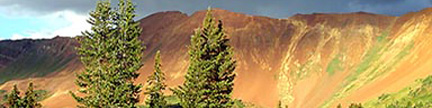
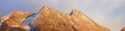
Temolime Trailhead |
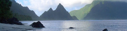
| This trailhead is at 7,980 feet, and provides access to the northwest side of Cerro Pedernal.
Go 27 miles northwest of Española on U.S. 84, and turn west onto New Mexico 96.
Go 11.5 miles west on New Mexico 96, turn south onto FS 100 (gravel), and measure from this point.
The turn onto FS 100 is 0.3 mile east of the post office in the small town of Youngsville.
Go south on FS 100, enter the Santa Fe National Forest at mile 3.1,
and reach the trailhead at mile 5.7 just before FS 100 crosses Temolime Canyon.
There is a 4WD road on the north side of the canyon, and 2WD vehicles should park here. |
| 4WD vehicles can proceed much closer to the peak. To do this, go 1.1 miles east up
Temolime Canyon on the 4WD road, crossing from the canyon’s north side
to its south side enroute. At 8,220 feet, turn sharply north on the main road,
cross back to the canyon’s north side and climb 0.5 mile north above the canyon.
When you reach a meadow at 8,480 feet, you will have an open view of the upper peak.
Just beyond this meadow, an old, blocked road goes straight ahead.
Stay on the main road, turn left and contour 0.5 mile west.
Look for a hard switchback to the east at an intersection at 8,680 feet.
To make this turn much easier, go 100 yards beyond it and turn around in a large area
designed for this purpose. Continue east then north on the road for another 0.8 mile
to some large meadows at 9,030 feet. This 4WD road will not be passable to vehicles
in winter or when it is wet. |