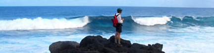
Come on Drummie, this peak will be off the map before you’re ready!
– Jim Long - Eyeing the dawn behind Organ Needle while pacing at the trailhead. |
Organ Needle – 8,990 feet |
Organ Needle is the highest peak in the Organ Mountains, which rise east of Las Cruces
in southern New Mexico. The spectacular, rocky peak just beats several other contenders for
highest honors, and the raucous range resembles a saw tuned by the sky.
Climbing Organ Needle will test more than your legs and lungs. |
 |
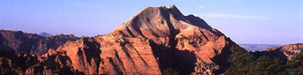
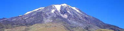
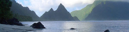
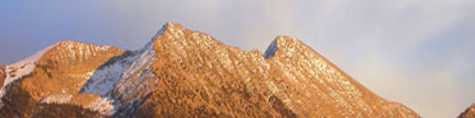
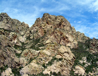
Organ Needle seen from the west
Organ Needle is the rounded summit on the right, and you can see Dark Saddle in its V-notch to the right of the summit
The summit on the left is Little Square Top, and you can see the distinctive Square Top on the left skyline |
 |
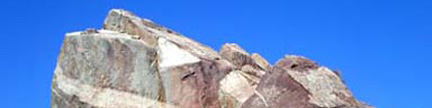
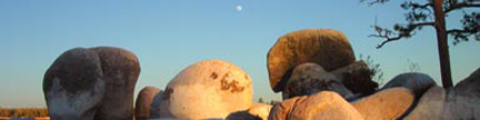
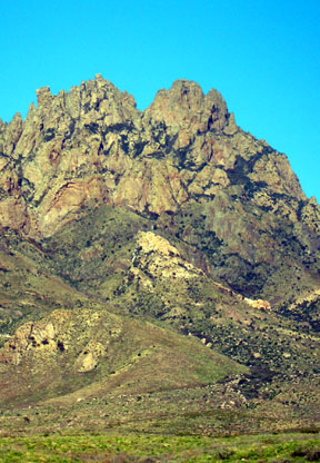
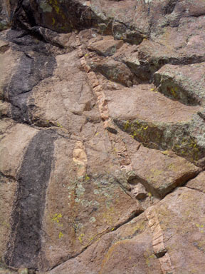
The yellow rocks |
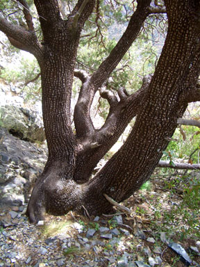 |
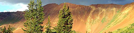
Alligator Juniper below the Gray Eminence |
 |
George Kasynski and Chip Drumwright arrive at Juniper saddle |
 |
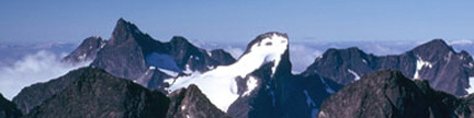
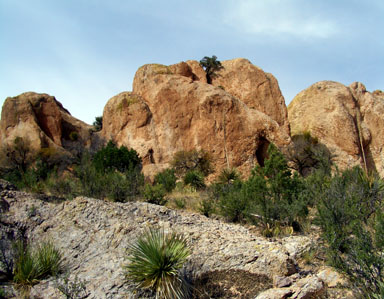
Organ Needle from the Gray Eminence |
 |
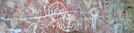
Rock art near the waterfall |
 |
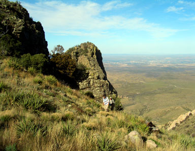
Jennifer in Dark Saddle |
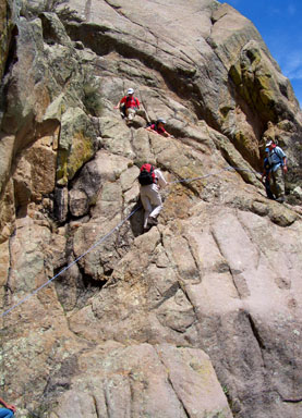 |
The Class 3 pitch |
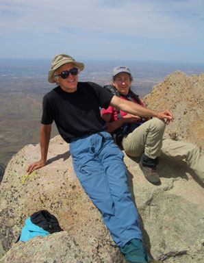 |
Jim Long and Susan Cooper on top of Organ Needle |
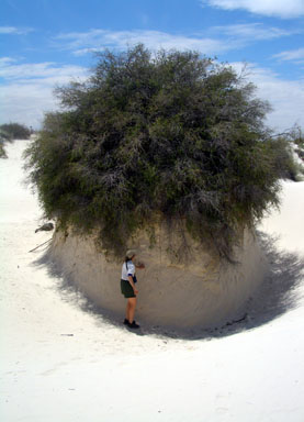 |
In White Sands National Monument |
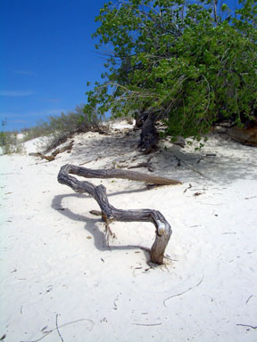 |
White Sand Art |
USGS 7.5’ Quadrangle: Organ Peak, NM |
West Face –
From Modoc Trailhead -
6.8 miles RT, 3,690 feet net, 4,300 feet total, Class 3
From Green Gate -
5.6 miles RT, 3,290 feet net, 3,900 feet total, Class 3
From end of 4WD road -
3.2 miles RT, 2,640 feet net, 3,250 feet total, Class 3 |
| This is the standard route up Organ Needle, and reaching this aloof aerie requires an arduous,
steep hike, capped by some Class 3 scrambling. There is a faint use trail for most of the upper route,
but the terrain is rough enough and complicated enough that if you lose the trail, you will probably
not make the peak. People climb Organ Needle in all seasons, but this is not a peak for all seasons.
The summer months can be brutally hot, and the upper route and crux, Class 3 wall will be especially
dangerous after winter storms, which can leave snow in Dark Canyon that will persist until spring.
The best seasons are spring and fall. |
| Start at the Modoc Trailhead at 5,300 feet,
and take some time to understand the complicated terrain that you are about to enter.
From the trailhead, you can see most of the Organ Mountains, and Organ Needle rises in the center of
the range at the southern end of the well-named Needles. The gulf of Fillmore Canyon is to the south
of Organ Needle. The major summit to the north of Organ Needle, which looks higher, is Little Square Top
with the distinctive Square Top block on its north side. Immediately to the south of Organ Needle is a
deep V-shaped notch that separates Organ Needle’s rounded summit from a pointy pinnacle with
its attendant “Retaining Wall.” The deep V-shaped notch, called Dark Saddle, is
at the top of Dark Canyon, which is the route’s key passage through imposing cliffs.
Below Dark Canyon you can see the 7,778-foot Gray Eminence, and below that you can see the upper
Modoc Mine Road slicing across the north side of a low hill with the spot elevation 6,301 feet.
Ready? Launch! |
| From the trailhead, hike east on the road for 0.6 mile to a green gate. Pass through the unlocked
gate, and continue another 1.2 miles on the road as it climbs to a ridge at 6,350 feet.
From here, you can see Fillmore Canyon to the south and several washes descending from the peaks above.
The route from here to Organ Needle is in the second wash to the south, not the first, and the route
now makes a lateral move to get into the second wash. Descend to the southeast on the continuing road,
cross the first wash, then climb steeply to the ridge between the first and second washes.
The road ends on this ridge, and two trails continue from this point. The trail heading up the hill
is destined for the first wash, and is not the route. Continue your lateral move by following the
faint trail to the southeast toward Fillmore Canyon until you pass below some prominent yellow rocks.
Enter the second wash just beyond the yellow rocks in a grove of oak trees. You have now finished
the approach to the base of the peak, and the steep part of your ascent is about to begin. |
| Climb out of the second wash on its south side, and take care to find the use trail that
exists on that slope. Initially, it can be hard to follow as it zigzags through slabby areas.
Follow the trail as it steepens, and hugs the bottom of the steep, north-facing cliffs of the
Gray Eminence. The trail tunnels through the trees in places, and you will have several opportunities
to hug the Alligator Juniper trees that grow near the base of the cliff. Persist with this steep
ascent until you reach Juniper Saddle, which is the 7,690-foot saddle between the 7,778-foot
Gray Eminence and the rest of Organ Needle. Juniper Saddle is a major milestone in your ascent,
and is a good place to preview the remaining 1,300 vertical feet of the route. An even better
place is the top of the Gray Eminence, which is a short hike up to the west. You can see
Organ Needle from these vantages, and the remaining route winds through near-barrier cliffs
to reach the base of Dark Canyon, which you cannot see from Juniper Saddle. |
| Climb east then southeast above Juniper Saddle, taking care to stay on the use trail as it hugs
the bottom of some imposing southwest-facing cliffs above the saddle. Three hundred yards above the
saddle you will reach the bottom of a seasonal waterfall, which drains the amphitheater above.
The area below the falls is the last place on the route to dry out, and you may see lizards and
chipmunks here enjoying this fact. |
| Climb southeast past the bottom of the waterfall, and ascend slabs on a wide ramp system between
steeper cliffs. When you are above the slabs, look carefully for a sharp left turn where the
hard-to-see-trail enters bushes and exits the ramp system. Many people get confused in this area,
and there are multiple trails above the ramp system. If you find yourself bushwhacking,
you are off route. Pick a trail, climb steeply, cross a small ridge, and continue east to the
bottom of Dark Canyon. Veer southeast (right), and begin your ascent of this vital passage.
In this area, the Alligator Juniper give way to some large Ponderosa Pines, and a little higher,
you can enjoy a Douglas Fir. Once into the narrow Dark Canyon, there is only one trail to follow,
and often enclosed by cliffs and trees, it hugs the north (left) side of the canyon. The
astonishing cliffs above you are the uppermost cliffs of Organ Needle, and at one point,
you pass directly below the summit. Ascend Dark Canyon all the way to 8,930-foot Dark Saddle
at the top of the canyon. You are now on the range crest, and can see the sweeping slabs of
Sugarloaf Peak to the southeast as well as the White Sands Missile Range.
You are tantalizingly close to the summit, but the route’s crux remains. |
| Cross Dark Saddle, descend 50 vertical feet to the east, go under the cliffs to the north
(left) and reach an improbable, flat, concrete sign that reads, “Needle. Go 125 feet
turn left then up.” Continue to hug the bottom of the cliffs, descend a little more,
and reach an area of broken rock. This is the beginning of the Class 3 scrambling.
Cross an awkward rib, and ascend a smooth V-slot above it (Class 3). Scamper 150 feet above
the V-slot (Class 2+) to the base of a solid rock wall. The wall above you to the northeast is
the famous crux pitch of this route, and many people use a rope here. Climb a 25-foot ascending
traverse along a disappearing crack system from lower left to upper right (Class 3).
Above the wall, scamper back left (Class 2+), follow the re emergent trail up a small rib to
reach the summit ridge, turn north (right), and walk 120 feet north to the highest point.
Breathe deep the desert air as you survey most of south-central New Mexico. |