Store
    Peaks
    Lists
    Photos
    Words
    Links
    About
    News
    Home
SummitSight.com
  • SummitSight.com
  • SummitSight.com
  • SummitSight.com
  • SummitSight.com
  • SummitSight.com
  • SummitSight.com
  • SummitSight.com
  • SummitSight.com
  • SummitSight.com
  • SummitSight.com

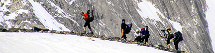
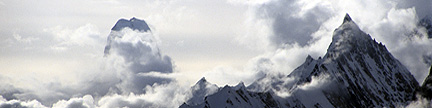
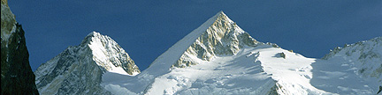
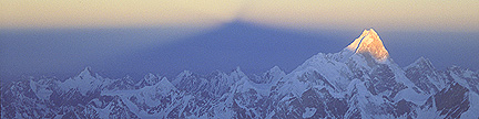
God was having a good day when he made Alaska.
– Bob Ross

Alaska’s Summits above 13,000 feet

– Sorted by Elevation

Notes
Rank Elev
feet
Prom
feet
Summit Name Proximate Parent
Line Parent (if diff)
Iso
miles
Quadrangle Rg G J
1 20,320 20,172 Denali - South Peak   TR Yanamax, China
Volcan Chimborazo, Ecuador
4,621.23
 
Mount McKinley A3 AR 3  
  19,470 1,320 Denali - North Peak Denali - South Peak 2.0 Mount McKinley A3 AR    
2 18,008 11,184 Saint Elias, Mount Logan, Mount, Canada 26.0 Mount Saint Elias B8 SE 1  
3 17,400 7,250 Foraker, Mount Denali - South Peak 14.4 Talkeetna D3 AR 1  
  16,812 262 “South Foraker” Foraker, Mount 1.0 Talkeetna D3 AR    
4 16,550 6,900 Bona, Mount Lucania, Mount, Canada 49.7 McCarthy B2 SE 1  
  16,550 300 “Southwest Foraker” Foraker, Mount 1.3 Talkeetna D3 AR    
5 16,390 10,540 Blackburn, Mount Bona, Mount 60.4 McCarthy C7 WR 1  
  16,286 536 “Kennedy Peak” Blackburn, Mount 1.5 McCarthy C7 WR 1  
6 16,237 7,687 Sanford, Mount Blackburn, Mount 40.1 Gulkana A1 WR 1 1
7 15,979 9,089 Vancouver, Mount
- Good Neighbor Peak
Logan, Mount, Canada 28.9 Mount Saint Elias B5 SE    
  15,660 410 “West Bona” Bona, Mount 1.3 McCarthy B3 SE    
  15,638 1,188 Churchill, Mount Bona, Mount 2.6 McCarthy B2 SE    
8 15,300 13,050 Fairweather, Mount Vancouver, Mount -
Good Neighbor Peak
124.4 Mount Fairweather D5 SE 1  
  15,050 200 “Northwest Foraker” Foraker, Mount 1.7 Talkeetna D3 AR    
9 14,950 8,700 Hubbard, Mount Vancouver, Mount -
Good Neighbor Peak
21.3 Mount Saint Elias B3 SE    
  14,916 166 “Southeast Churchill” Bona, Mount 2.6 McCarthy B2 SE    
10 14,831 5,181 Bear, Mount Bona, Mount 21.3 McCarthy B1 SE    
  14,660 110 “North Churchill” Bona, Mount 3.9 McCarthy B2 SE    
11 14,573 4,623 Hunter, Mount - North Peak Denali - South Peak 8.6 Talkeetna D3 AR 1  
  14,500 1,950 Alverstone, Mount Hubbard, Mount 2.3 Mount Saint Elias B3 SE    
12 14,470 3,220 University Peak Bona, Mount 4.2 McCarthy B3 SE    
  14,450 1,500 Aello Peak Bona, Mount 5.4 McCarthy B3 SE    
  14,260 400 “Snave, The” Blackburn, Mount 3.2 McCarthy C7 WR 2  
13 14,163 5,613 Wrangell, Mount Sanford, Mount 14.8 Gulkana A1 WR    
14 14,070 5,081 Augusta, Mount Saint Elias, Mount 16.2 Mount Saint Elias B7 SE    
  14,013 563 “Perch Peak” Wrangell, Mount 1.5 Gulkana A1 WR 1  
  13,966 1,116 Hunter, Mount - South Peak Hunter, Mount - North Peak 2.2 Talkeetna D3 AR    
  13,950 1,000 “East Aello Peak” Bona, Mount 4.5 McCarthy B3 SE    
  13,950 1,000 “The Claw” Bona, Mount 4.8 McCarthy B3 SE    
15 13,860 2,210 West Atna Peak Blackburn, Mount 6.5 McCarthy C6 WR    
16 13,845 4,395 Regal Mtn West Atna Peak 12.2 McCarthy C5 WR    
17 13,832 11,507 Hayes, Mount Sanford, Mount 126.8 Mount Hayes C6 AR    
  13,820 70 “South Fairweather” Fairweather, Mount 1.0 Mount Fairweather D5 SE    
18 13,760 7,710 Cook, Mount Vancouver, Mount -
Good Neighbor Peak
14.5 Mount Saint Elias A6 SE    
  13,650 400 East Atna Peak West Atna Peak 0.6 McCarthy C6 WR    
  13,605 455 “West Fairweather” Fairweather, Mount 1.3 Mount Fairweather D5 SE    
  13,560 1,310 Quincy Adams, Mount Fairweather, Mount 2.7 Mount Fairweather D5 SE    
  13,550 1,500 Ocypete Peak Bona, Mount 7.1 McCarthy B3 SE    
  13,535 185 “South Quincy Adams” Quincy Adams, Mount 0.4 Mount Fairweather D5 SE    
  13,450 600 Hunter, Mount - Middle Peak Hunter, Mount - North Peak 1.5 Talkeetna D3 AR    
  13,440 1,490 East Kahiltna Peak Denali - South Peak 3.7 Talkeetna D3 AR 1  
19 13,421 4,771 Jarvis, Mount Wrangell, Mount 13.0 Nabesna A6 WR    
  13,350 1,300 Celeno Peak Bona, Mount 8.0 McCarthy B3 SE    
  13,350 600 “The Fin” Foraker, Mount 4.1 Talkeetna D4 AR    
20 13,345 5,895 Natazhat, Mount Bear, Mount 16.5 McCarthy C1 SE    
  13,315 1,665 “East Bona” Bona, Mount 3.3 McCarthy B2 SE    
  13,305 800 “South Hayes” Hayes, Mount 1.1 Mount Hayes C6 AR    
  13,280 930 “Parka Peak” West Atna Peak 2.2 McCarthy C6 WR    
21 13,220 3,270 Silverthrone, Mount Denali - South Peak 10.8 Mount McKinley A2 AR    
22 13,176 10,751 Marcus Baker, Mount Wrangell, Mount 128.3 Anchorage B2/B3 CG    
  13,025 775 “North Jarvis” Jarvis, Mount 3.1 Nabesna A6 WR    
23 13,020 3,970 Moffit, Mount Hayes, Mount 10.4 Mount Hayes C5 AR    
  13,009 959 Zannett, Mount Wrangell, Mount 3.8 Gulkana A1 WR    

Notes by Gerry Roach

  1. Our Alaska climbs above 13,000feet
    Gerry Roach’s totals: 15 ascents; 8/23 hard ranked; 12/54 overall
    Jennifer Roach’s totals: 1 ascent; 1/23 hard ranked; 1/54 overall
    Gerry and Jennifer’s combined total as of 5/29/11: 16 ascents

  2. There are 54 summits on this list, of which 23 are hard ranked.

  3. For this list, I require that a hard ranked summit have at least 2,000 feet of prominence.

  4. Denali South Peak - First ascent June 7, 1913 by Hudson Stuck, Harry Karstens, Walter Harper, and Robert G. Tatum via the Muldrow Glacier.

  5. Denali North peak - First ascent April 3, 1910 by the Sourdoughs Billy Taylor and Peter Anderson via the Muldrow Glacier.

  6. St Elias - First ascent 1897 by the Duke of the Abruzzi, Vittorio Sella, and party via the North (Abruzzi) Ridge.

  7. Foraker - First ascent August 6, 1934 by Charles S. Houston, T. Graham Brown, and Chychele Waterson via the Northwest Ridge.

  8. South Foraker - First ascent August 9, 1934 by Charles S. Houston, T. Graham Brown, and Chychele Waterson via the Northwest Ridge.

  9. Bona - First ascent in 1930 by Alan Carpe, Andy Taylor, and Terris Moore. Many large-scale maps show Bona at 16,421 feet, but the McCarthy B2 Quad clearly shows the 16,500-foot contour, hence the given altitude of 16,550 feet.

  10. Blackburn has two summits. The western summit is the mountain’s highpoint, a fact that was not understood until the 1960s when the then new USGS maps came out. The first ascent of the west peak, and hence Mount Blackburn, was done on May 30, 1958 by Bruce Gilbert, Dick Wahlstrom, Hans Gmoser, Adolf Bitterlich, and Leon Blumer via the Northwest Ridge. This intrepid team made the first ascent of Blackburn, but did not even know it at the time! Blumer’s article in the 1959 American Alpine Journal is titled “Mount Blackburn - Second Ascent.”

  11. “Kennedy Peak” is “East Blackburn.” First ascent in 1912 by Dora Keen and George Handy via the Kennicot Glacier and East Face. This heady exploit was ahead of its time. Dora Keen, driven by a deep desire for the climb, solicited miners from the nearby Kennicot Copper Mine, and forged a route up the heavily crevassed East Face to the East Peak, but did not traverse over to the West Peak. Dora went on to write a famous article for the Saturday Evening Post titled, “First up Mount Blackburn.” In 1912, Dora and George thought they were on Blackburn’s highest point, a misconception that was not understood until the 1960s, when the then new USGS maps came out showing the West Peak to be higher. With global warming, Dora’s route is not practical today. The second ascent of Blackburn’s East Peak was made in 1977 by Gerry Roach and party via the Southeast Ridge. Gerry’s party in 1977 reached the East Peak first, traversed to the West Peak, and descended the Northwest Ridge to complete the first traverse of Blackburn. The elusive East Peak had gone 65 years without a human footstep!

  12. Sanford - First ascent in 1938 by Bradford Washburn and Terris Moore via the Sheep Glacier.

  13. Mount Vancouver has three summits connected by a linear, north-south ridge, and the question of which summit is the high point of Mount Vancouver is an interesting one. The middle summit is lower than both the north and south summits. The south summit is the one that is the border summit between the United States and Canada, and this summit is known as “Good Neighbor Peak.” The wisdom of the ages is that the north peak is the highest, and this is based on the old 1:250,000 Canadian map that shows all three summits. The 1:50,000 Canadian map is based on the 1:250,000 and does not add any new information, but it does have a smaller (40M) contour interval. Based on this, the best Canadian map, the elevations of the three summits are: north 15,787 feet, middle 15,551feet, and south (Good Neighbor Peak) 15,682 feet.

    So what’s the mystery? The USGS 1:63,360 St Elias B5 Quadrangle clearly shows the south summit (Good Neighbor Peak) to be 15,979 feet, which is an astonishing difference of 292 feet. Sadly, the USGS map does not show the middle or north summits at all. Clearly, either the Canadian or US map, or possibly both, are in error. It is likely that the newer USGS map is more accurate than the old Canadian map, which derives from a much larger scale. Thus the higher elevation for the south summit (Good Neighbor Peak) appears to be the best number. This opens the intriguing possibility that the north peak, always believed to be higher, is actually over 16,000 feet. Indeed, adding 292 feet to the north peak would give it an elevation of 16,079 feet. I believe that the entire massif is higher than indicated by the Canadian maps, however I cannot invent a topography, and must use the best maps available for making this list. Accordingly, I assume that the elevations of the three summits are north 15,787 feet, middle 15,551 feet, and south (Good Neighbor Peak) 15,979 feet, and that the south summit (Good Neighbor Peak) is the high point of Mount Vancouver.

  14. Fairweather - First ascent in 1931 by Allan Carpe and Terris Moore.

  15. Hubbard - First ascent in 1951.

  16. Bear - First ascent in 1951.

  17. Hunter - First ascent July 4, 1954 by Fred Beckey, Heinrich Harrer, and Henry Mehbohm via the West Ridge.

  18. Alverstone - First ascent in 1951.

  19. University - First ascent June 19 and 20 1955 by Keith Hart, Leon Blumer, Sheldon Brooks, Tim Kelley, Norman Sanders, and Gibson Reynolds via the Hawkins Glacier and North Ridge.

  20. Aello, Ocypete, and Celeno Peaks are part of the Twaharpies Group, and these names became official in 1967. Aello Peak has three summits of nearly equal height. The Harpies were creatures from ancient Greek mythology, whose name literally means “snatchers.” They were the personification of whirlwinds and hurricanes. With head and trunk of a winged woman, claws and tail of a bird, ravenous and filthy, these repulsive beings served as the ministers of divine vengeance, and defiled all they touched.

  21. “The Snave” - Climbed by Gerry Roach and party in 1977 as part of the first traverse of Blackburn. Inspiration for the name came during a long storm. Snave is Evans spelled backwards, and the Snave’s elevation of 14,260 feet is nearly equal to the elevation of Colorado’s Mount Evans. Other than this similarity, the difference between the Snave and Mount Evans is striking.

  22. Wrangell - First ascent in 1908 by R. Dunne and W. Sowle.

  23. Augusta - First ascent July 4 1952 by Peter Schoening, Vic Josendal, Dick McGowan, Bill Niendorff, Bob Yeasting, Verl Rogers, Gibson Reynolds, and Tom Morris via the lower Northwest Spur and upper North Ridge.

  24. “Perch Peak” is “West Wrangell.” Unaware of the Harpies, Gerry often perched peacefully on this summit in 1964 when he spent the summer on top of Mount Wrangell.

  25. Regal - First ascent August 3 1964 by Yasuichi Kitamura, Ryoichi Hasegawa, Masao Tanaka, and Shinichi Naito.

  26. Hayes - First ascent in 1941.

  27. Cook - First ascent August 1 1953 by Dick McGowan, Franz Mohling, Tom Miller, and Tim Kelly via the North Face.

  28. Moffit - First ascent in 1941.
Copyright © 2001-2023 by Gerry Roach. All Rights Reserved.
Click to return to the Main Menu Click to return to the Main Menu Click to return to the Main Menu Click to return to the Main Menu Click for the banner photo