|
|
|
|
|
|
|
|
|
|
|
|
|
|
|
|
|
|
 |
 |
|
|
 |
|
|
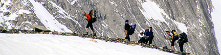
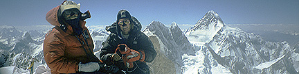
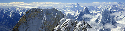
For information about mountaineering on these magnificent mountains, |
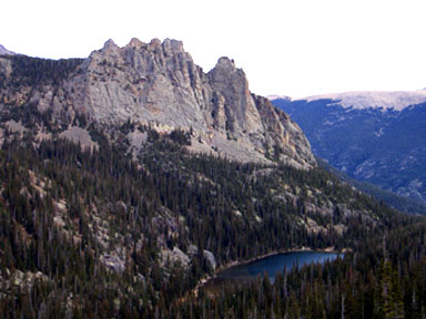
Rocky Mountain National Park Region Summits– Sorted by ElevationNotes |
| Rank RMR |
Elev feet |
Prom feet |
Summit Name | Parent | Iso miles |
Quadrangle | Rg | Sg | G | J |
| 1 | 14,255 | 2,940 | Longs Peak EB | Torreys Peak | 43.71 | Longs Peak | FR | RM | 19 | 5 |
| 14,060 | 240 | “Southeast Longs” EB | Longs Peak | 0.10 | Longs Peak | FR | RM | 1 | ||
| 2 | 13,911 | 451 | Meeker, Mount EB | Longs Peak | 0.73 | Allens Park | FR | RM | 7 | 4 |
| 13,860 | 40 | Meeker Ridge EB | Meeker, Mount | 0.17 | Allens Park | FR | RM | 2 | 1 | |
| 13,820 | 20 | Keyboard of the Winds EB | Longs Peak | 0.24 | Longs Peak | FR | RM | |||
| 3 | 13,579 | 719 | Chiefs Head Peak | Longs Peak | 1.39 | Isolation Peak | FR | RM | 2 | 4 |
| 4 | 13,560 | 2,420 | Hagues Peak | Longs Peak | 15.97 | Trail Ridge | FR | RM MU |
3 | 3 |
| 5 | 13,514 | 1,134 | Ypsilon Mountain | Hagues Peak | 2.63 | Trail Ridge | FR | RM MU |
4 | 2 |
| 6 | 13,502 | 922 | Fairchild Mountain | Ypsilon Mountain | 1.18 | Trail Ridge | FR | RM MU |
3 | 3 |
| 7 | 13,497 | 397 | Pagoda Mountain EB | Longs Peak | 0.65 | Isolation Peak | FR | RM | 2 | 2 |
| 8 | 13,425 | 485 | Mummy Mountain | Hagues Peak | 1.36 | Estes Park | FR | RM MU |
3 | 4 |
| 13,420 | 200 | Rowe Peak | Hagues Peak | 0.41 | Trail Ridge | FR | RM MU |
2 | 1 | |
| 13,340 | 40 | Ships Prow EB | Longs Peak | 0.46 | Longs Peak | FR | RM | 1 | ||
| 13,340 | 40 | Glacier Ridge EB | Longs Peak | 0.45 | Longs Peak | FR | RM | 1 | ||
| 9 | 13,327 | 827 | McHenrys Peak | Chiefs Head Peak | 1.24 | McHenrys Peak | FR | RM | 2 | 1 |
| 13,326 | 186 | Storm Peak B EB | Longs Peak | 0.79 | Longs Peak | FR | RM | 3 | 6 | |
| 10 | 13,310 | 850 | Alice, Mount | Chiefs Head Peak | 1.37 | Isolation Peak | FR | RM | 2 | 2 |
| 11 | 13,281 | 301 | Lady Washington, Mount EB | Longs Peak | 0.76 | Longs Peak | FR | RM | 5 | 6 |
| 12 | 13,208 | 388 | Powell Peak | McHenrys Peak | 0.44 | McHenrys Peak | FR | RM | 3 | 1 |
| 13,184 | 44 | Rowe Mountain | Hagues Peak | 0.86 | Trail Ridge | FR | RM MU |
2 | 1 | |
| 13 | 13,176 | 1,156 | Copeland Mountain | Alice, Mount | 4.06 | Isolation Peak | FR | RM | 1 | 4 |
| 14 | 13,153 | 413 | Taylor Peak B | Powell Peak | 1.03 | McHenrys Peak | FR | RM | 3 | 5 |
| 15 | 13,138 | 718 | Ogalalla Peak | Copeland Mountain | 1.36 | Isolation Peak | FR | RM IP |
3 | 2 |
| 16 | 13,118 | 938 | Isolation Peak | Copeland Mountain | 2.18 | Isolation Peak | FR | RM | 2 | 3 |
| S1 | 13,069 | 283 | Chiquita, Mount | Ypsilon Mountain | 1.00 | Trail Ridge | FR | RM MU |
4 | 2 |
| 17 | 12,949 | 489 | East Desolation Peak | Ypsilon Mountain | 1.17 | Trail Ridge | FR | RM MU |
1 | 1 |
| 18 | 12,940 | 2,680 | Richthofen, Mount | Clark Peak B | 9.67 | Mt Richthofen | FR | RM NS |
1 | 2 |
| 19 | 12,928 | 1,220 | Julian, Mount | Ypsilon Mountain Taylor Peak B |
7.18 |
Grand Lake | FR | RM | 2 | 1 |
| 20 | 12,922 | 902 | Stones Peak | Julian, Mount | 2.26 | McHenrys Peak | FR | RM | 1 | 2 |
| 12,918 | 178 | West Desolation Peak | East Desolation Peak | 0.20 | Trail Ridge | FR | RM MU |
1 | 1 | |
| 21 | 12,900 | 560 | Ida, Mount | Julian, Mount | 1.14 | Grand Lake | FR | RM | 5 | 3 |
| 22 | 12,848 | 468 | Elk Tooth | Ogalalla Peak | 0.66 | Isolation Peak | FR | RM IP |
1 | 1 |
| 23 | 12,820 | 400 | Point 12,820 | Ida, Mount Julian, Mount |
0.67 |
Grand Lake | FR | RM | 4 | 4 |
| 24 | 12,810 | 880 | Howard Mountain | Richthofen, Mount | 2.95 | Mt Richthofen | FR | RM NS |
1 | 1 |
| 12,804 | 104 | Chief Cheley Peak | Point 12,820 | 0.25 | Grand Lake | FR | RM | 4 | 4 | |
| 25 | 12,797 | 417 | Cirrus, Mount | Howard Mountain | 0.56 | Mt Richthofen | FR | RM NS |
2 | 2 |
| 12,780 | 80 | Cracktop | Point 12,820 | 0.25 | Grand Lake | FR | RM | 3 | 4 | |
| 12,736 | 236 | “Stapps Peak” | Stones Peak | 0.58 | McHenrys Peak | FR | RM | 1 | 1 | |
| 26 | 12,725 | 425 | Cumulus, Mount | Howard Mountain | 1.16 | Mt Richthofen | FR | RM NS |
1 | 1 |
| 12,718 | 258 | Terra Tomah Mountain | Julian, Mount | 0.61 | Trail Ridge | FR | RM | 1 | 1 | |
| 27 | 12,716 | 1,456 | Point 12,716 | Hagues Peak | 5.02 | Comanche Peak | FR | RM CP MU |
1 | 1 |
| 12,716 | 256 | Ouzel Peak | Ogalalla Peak | 1.12 | Isolation Peak | FR | RM | 2 | 2 | |
| 28 | 12,713 | 733 | Hallett Peak | Taylor Peak B | 1.98 | McHenrys Peak | FR | RM | 4 | 9 |
| 29 | 12,713 | 573 | Sprague Mountain | Stones Peak | 0.99 | McHenrys Peak | FR | RM | 2 | 5 |
| 12,710 | 110 | Comanche Peak B | Point 12,716 | 0.47 | Comanche Peak | FR | RM CP MU |
2 | 2 | |
| 30 | 12,706 | 646 | Nimbus, Mount | Cumulus, Mount | 0.95 | Mt Richthofen | FR | RM NS |
1 | 2 |
| 12,668 | 88 | Thatchtop | Powell Peak | 1.08 | McHenrys Peak | FR | RM | 2 | 4 | |
| 12,660 | 240 | Arrowhead | McHenrys Peak | 0.51 | McHenrys Peak | FR | RM | 2 | 1 | |
| 31 | 12,632 | 332 | Mahana Peak | Isolation Peak | 0.62 | Isolation Peak | FR | RM | 2 | 2 |
| 32 | 12,630 | 490 | Sharkstooth, The | Taylor Peak B | 0.55 | McHenrys Peak | FR | RM | 2 | 1 |
| 12,580 | 240 | Static Peak | Richthofen, Mount | 0.54 | Mt Richthofen | FR | RM NS |
1 | 1 | |
| 12,575 | 275 | Spearhead, The | Chiefs Head Peak | 0.43 | McHenrys Peak | FR | RM | 2 | 1 | |
| 12,571 | 231 | Dunraven, Mount | Mummy Mountain | 1.3 | Estes Park | FR | RM MU |
1 | 1 | |
| 33 | 12,565 | 1,185 | Andrews Peak | Alice, Mount | 2.47 | Isolation Peak | FR | RM | 2 | 1 |
| 12,540 | 160 | Stratus, Mount | Nimbus, Mount | 0.44 | Mt Richthofen | FR | RM NS |
1 | 1 | |
| 34 | 12,537 | 477 | Lead Mountain A | Cirrus, Mount | 0.99 | Mt Richthofen | FR | RM NS |
1 | 1 |
| 35 | 12,524 | 1,264 | Bowen Mountain | Nimbus, Mount | 2.94 | Bowen Mountain | FR | NS | 2 | 1 |
| 12,500 | 120 | Hayden Spire | Sprague Mountain | 0.44 | McHenrys Peak | FR | RM | 1 | 1 | |
| 12,500 | 80 | Hart Ridge | Cirrus, Mount | 0.42 | Mt Richthofen | FR | RM NS |
2 | 1 | |
| 36 | 12,493 | 513 | Mahler, Mount | Richthofen, Mount | 0.76 | Mt Richthofen | FR | NS | 1 | 1 |
| 37 | 12,489 | 1,731 | Specimen Mountain | Lead Mountain A Ida, Mount |
4.68 |
Fall River Pass | FR | RM | 1 | 2 |
| 38 | 12,486 | 426 | Otis Peak | Hallett Peak | 0.80 | McHenrys Peak | FR | RM | 4 | 7 |
| 39 | 12,485 | 345 | North Nokhu Crag | Richthofen, Mount | 1.10 | Mt Richthofen | FR | NS CO |
1 | |
| 12,480 | 180 | South Nokhu Crag | North Nokhu Crag | 0.08 | Mt Richthofen | FR | NS CO |
1 | 2 | |
| 40 | 12,466 | 1,166 | Sundance Mountain A | Julian, Mount Ida, Mount |
3.57 |
Trail Ridge | FR | RM | 2 | 3 |
| 41 | 12,454 | 434 | Chapin, Mount | Sundance Mountain A Ypsilon Mountain |
1.81 |
Trail Ridge | FR | RM MU |
3 | 3 |
| 42 | 12,438 | 458 | “Never Summer Peak” | Lead Mountain A | 0.5 | Mt Richthofen | FR | RM NS |
1 | 1 |
| 43 | 12,420 | 359 | Tanima Peak | Mount Alice | 1.4 | Isolation Peak | FR | RM | 1 | 2 |
| S2 | 12,397 | 297 | Baker Mountain | Nimbus, Mount | 1.1 | Mt Richthofen | FR | RM NS |
1 | 1 |
| 44 | 12,394 | 414 | Parika Peak | Bowen Mountain | 1.8 | Mt Richthofen | FR | NS | 1 | 1 |
| 12,380 | 120 | Tepee Mountain | Richthofen, Mount | 0.4 | Mt Richthofen | FR | RM NS |
1 | 1 | |
| 45 | 12,375 | 595 | Watanga Mountain | Hiamovi Mountain | 1.2 | Isolation Peak | FR | RM IP |
1 | 3 |
| 12,363 | 183 | Ptarmigan Point | Hallett Peak | 1.1 | McHenrys Peak | FR | RM | 5 | 2 | |
| 46 | 12,355 | 535 | Trail Ridge | Sundance Mountain A | 2.9 | Fall River Pass | FR | RM | 1 | |
| 12,335 | 235 | Flatiron Mountain A | East Desolation Peak | 1.33 | Trail Ridge | FR | RM MU |
1 | 1 | |
| 12,331 | 151 | Knobtop Mountain | Hallett Peak | 1.7 | McHenrys Peak | FR | RM | 3 | 3 | |
| 47 | 12,324 | 304 | Ptarmigan Mountain | Andrews Peak | 1.38 | McHenrys Peak | FR | RM | 2 | 1 |
| 12,324 | 24 | Flattop Mountain A | Hallett Peak | 0.46 | McHenrys Peak | FR | RM | 8 | 12 | |
| 48 | 12,308 | 408 | Point 12,308 | Point 12,716 | 1.6 | Comanche Peak | FR | RM CP MU |
1 | 1 |
| 49 | 12,307 | 407 | “North Specimen” | Specimen Mountain | 0.6 | Fall River Pass | FR | RM | 1 | 1 |
| 50 | 12,305 | 325 | “Dundicking” | Mummy Mountain | 1.8 | Estes Park | FR | RM MU |
1 | 1 |
| 51 | 12,303 | 843 | Cascade Mountain | Bowen Mountain | 1.9 | Bowen Mountain | FR | NS | 1 | 1 |
| 12,300 | 200 | Green Knoll | Nimbus, Mount | 0.8 | Mt Richthofen | FR | RM NS |
1 | 1 | |
| 52 | 12,296 | 2,676 | Parkview Mountain TR | Cascade Mountain | 9.4 | Parkview Mountain | RE | 1 | 3 | |
| 53 | 12,274 | 734 | Snowdrift Peak | Sprague Mountain | 2.5 | McHenrys Peak | FR | RM | 2 | 3 |
| 54 | 12,265 | 1,005 | Iron Mountain | South Nokhu Crag | 2.7 | Chambers Lake | FR | NS CO |
2 | 1 |
| 55 | 12,258 | 318 | Fall Mountain | Point 12,716 | 2.0 | Comanche Peak | FR | RM CP MU |
1 | 1 |
| 56 | 12,253 | 553 | “Paprika Peak” | Parika Peak | 0.6 | Mt Richthofen | FR | NS | 1 | 1 |
| 57 | 12,250 | 350 | “Fleur de Lis” | Isolation Peak | 1.5 | Isolation Peak | FR | RM | 1 | 1 |
| 12,246 | 146 | Farview Mountain | Parika Peak | 0.5 | Mt Richthofen | FR | NS | 1 | 1 | |
| 58 | 12,241 | 381 | “Ptarmigan’s Beak” | Andrews Peak | 0.8 | Isolation Peak | FR | RM | 2 | |
| 59 | 12,228 | 888 | Lulu Mountain | North Nokhu Crag | 1.6 | Fall River Pass | FR | RM | 2 | 2 |
| S3 | 12,220 | 280 | Eagles Beak | Tanima Peak | 0.5 | Isolation Peak | FR | RM | 1 | 2 |
| 12,220 | 120 | Cleaver, The | Tanima Peak | 0.5 | Isolation Peak | FR | RM | 1 | 1 | |
| 12,220 | 80 | Pilot Mountain | Alice, Mount | 0.6 | Isolation Peak | FR | RM | 1 | 1 | |
| 12,220 | 80 | Dragons Egg Rock EB | Meeker, Mount | 0.5 | Allens Park | FR | RM | 1 | 1 | |
| 60 | 12,216 | 636 | Nakai Peak | Point 12,820 | 1.5 | Grand Lake | FR | RM | 2 | 3 |
| 61 | 12,162 | 902 | Saint Vrain Mountain | “Red Deer Mountain” | 2.9 | Allens Park | FR | RM IP |
3 | 7 |
| 62 | 12,148 | 488 | West Stormy Peak | “Dundicking” | 2.2 | Pingree Park | FR | RM CP MU |
1 | 1 |
| S4 | 12,140 | 280 | Sugarloaf Mountain | West Stormy Peak | 1.6 | Pingree Park | FR | RM MU |
1 | 1 |
| 12,129 | 109 | Notchtop Mountain | Hallett Peak | 1.2 | McHenrys Peak | FR | RM | 3 | 1 | |
| 63 | 12,121 | 301 | Adams, Mount | Watanga Mountain | 1.5 | Isolation Peak | FR | RM | 1 | 2 |
| 64 | 12,098 | 398 | “Lone Ranger, The” | Cirrus, Mount | 0.8 | Mt Richthofen | FR | NS | 1 | 1 |
| 65 | 12,060 | 400 | Thunder Mountain B | Lulu Mountain | 0.6 | Fall River Pass | FR | RM NE MU |
1 | 2 |
| 66 | 12,060 | 360 | “North Iron” | Iron Mountain | 0.8 | Chambers Lake | FR | NS CO |
1 | 1 |
| 12,060 | 200 | Skull Point | Fall Mountain | 1.9 | Comanche Peak | FR | RM MU |
1 | 1 | |
| 67 | 12,047 | 627 | Cindy, Mount | Cumulus, Mount | 2.1 | Mt Richthofen | FR | NS | 1 | 1 |
| 12,044 | 64 | Battle Mountain EB | Lady Washington, Mount | 1.1 | Longs Peak | FR | RM | 2 | 1 | |
| 12,020 | 80 | East Stormy Peak | West Stormy Peak | 0.5 | Pingree Park | FR | RM CP MU |
1 | 1 | |
| 68 | 12,018 | 318 | “Electrode, The” | Richthofen, Mount | 0.8 | Mt Richthofen | FR | RM NS |
1 | 1 |
| 69 | 12,008 | 308 | Ruby Mountain | Cascade Mountain | 1.0 | Bowen Mountain | FR | NS | 1 | 1 |
| 70 | 12,007 | 347 | Craig, Mount | “Fleur de Lis” | 1.5 | Isolation Peak | FR | RM | 1 | 1 |
| 12,005 | 225 | “Fall River Pass Mountain” | “Trail Ridge” | 1.10 | Trail Ridge | FR | RM | 2 | 1 | |
| 11,980 | 200 | “Aiguille de Fleur” | “Fleur de Lis” | 0.4 | Isolation Peak | FR | RM | |||
| 71 | 11,957 | 617 | Twin Peaks | Adams, Mount | 1.7 | Shadow Mountain | FR | RM IP |
1 | 1 |
| 11,939 | 119 | Gabletop Mountain | Stones Peak | 1.8 | McHenrys Peak | FR | RM | 2 | 2 | |
| 72 | 11,909 | 369 | Marmot Point | Trail Ridge | 1.4 | Trail Ridge | FR | RM | 2 | 2 |
| 11,909 | 49 | Pine Ridge TR EB | Lady Washington, Mount | 1.7 | Longs Peak | FR | RM | 1 | 1 | |
| 73 | 11,860 | 440 | “Poudre Peak” | “North Specimen” | 2.0 | Fall River Pass | FR | RM | 1 | |
| 74 | 11,859 | 639 | Point 11,859 | Point 12,308 | 2.3 | Comanche Peak | FR | CP MU |
||
| 11,831 | 171 | Dickinson, Mount | “Dundicking” | 1.5 | Estes Park | FR | RM MU |
1 | 2 | |
| 75 | 11,769 | 1,389 | Gravel Mountain | Cascade Mountain | 4.9 | Bowen Mountain | FR | NS | ||
| 11,740 | 80 | North Ridge | Pagoda Mountain | 1.4 | Allens Park | FR | RM | 1 | ||
| 11,734 | 154 | Neota, Mount | Thunder Mountain | 0.5 | Fall River Pass | FR | RM NE NS |
1 | 1 | |
| 11,724 | 64 | Mount Orton | Pagoda Mountain | 1.6 | Allens Park | FR | RM | 3 | 2 | |
| 76 | 11,722 | 302 | Tombstone Ridge | Sundance Mountain A | 3.0 | Trail Ridge | FR | RM | 2 | 1 |
| 77 | 11,721 | 301 | “Roaring Peak” | Adams, Mount | 0.7 | Isolation Peak | FR | RM IP |
1 | 1 |
| 78 | 11,704 | 524 | Jackstraw Mountain | Ida, Mount | 2.1 | Fall River Pass | FR | RM | 1 | 2 |
| 79 | 11,700 | 360 | Bearpaws Peaks | Cindy, Mount | 1.7 | Mt Richthofen | FR | NS | 1 | 1 |
| 11,686 | 186 | Blue Ridge | Cascade Mountain | 1.5 | Bowen Mountain | FR | NS | |||
| 80 | 11,637 | 617 | Crown BM | Point 11,859 | 4.2 | Comanche Peak | FR | CP MU |
1 | |
| 81 | 11,632 | 412 | Meadow Mountain B | Saint Vrain Mountain | 1.2 | Allens Park | FR | RM IP |
3 | 11 |
| 11,605 | 225 | Red Mountain I | Nimbus, Mount | 1.3 | Mt Richthofen | FR | RM NS |
1 | 1 | |
| 11,586 | 26 | Little Matterhorn | Hallett Peak | 1.7 | McHenrys Peak | FR | RM | 2 | 1 | |
| 11,582 | 82 | Ramsey Peak | West Stormy Peak | 1.5 | Pingree Park | FR | RM MU |
1 | 1 | |
| 11,509 | 249 | Little Gravel Mountain | Gravel Mountain | 1.4 | Radial Mountain | FR | NS | 1 | ||
| 11,488 | 148 | Mineral Point B | Bowen Mountain | 1.5 | Bowen Mountain | FR | NS | 1 | 1 | |
| 11,482 | 222 | Half Mountain | Lady Washington, Mount | 2.3 | McHenrys Peak | FR | RM | 2 | 1 | |
| 82 | 11,463 | 803 | Bighorn Mountain | Mummy Mountain | 3.2 | Estes Park | FR | RM MU |
4 | 7 |
| 83 | 11,463 | 323 | Crown Point | Crown BM | 1.5 | Comanche Peak | FR | CP MU |
1 | |
| 84 | 11,453 | 473 | Seven Utes Mountain | Mahler, Mount | 1.4 | Mt Richthofen | FR | NS CO |
1 | 1 |
| 85 | 11,428 | 2,288 | East Twin Sisters Peak EB | Lady Washington, Mount | 5.1 | Longs Peak | FR | RM | 4 | 4 |
| 86 | 11,424 | 604 | Patterson, Mount | Snowdrift Peak | 2.4 | Grand Lake | FR | RM | 1 | 1 |
| 11,413 | 73 | West Twin Sisters Peak EB | East Twin Sisters Peak | 0.1 | Longs Peak | FR | RM | 4 | 4 | |
| 87 | 11,384 | 364 | Twin Sisters Mountain EB | East Twin Sisters Peak | 0.45 | Longs Peak | FR | RM | 4 | 1 |
| 11,355 | 255 | Flat Top Mountain | Iron Mountain | 2.2 | Chambers Lake | FR | NS NE |
1 | ||
| 11,340 | 160 | Shipler Mountain | Specimen Mountain | 1.9 | Fall River Pass | FR | RM | 1 | 2 | |
| 11,335 | 235 | Northeast Porphyry Peak | Gravel Mountain | 3.1 | Bowen Mountain | FR | NS | 1 | ||
| 88 | 11,262 | 802 | Signal Mountain TR | West Stormy Peak | 4.0 | Pingree Park | FR | CP MU |
3 | 4 |
| 89 | 11,254 | 314 | Tileston, Mount | Bighorn Mt | 1.2 | Estes Park | FR | RM MU |
2 | 4 |
| 11,248 | 220 | South Signal Mountain TR | Signal Mountain | 0.6 | Pingree Park | FR | RM CP MU |
3 | 3 | |
| 90 | 11,241 | 1,421 | Radial Mountain TR | Cascade Mountain | 5.1 | Radial Mountain | FR | 1 | 1 | |
| 91 | 11,220 | 800 | Point 11,220 | “Poudre Peak” | 2.8 | Trail Ridge | FR | RM | 1 | 1 |
| 92 | 11,161 | 421 | Southwest Porphyry Peak | Gravel Mountain | 2.5 | Bowen Mountain | FR | NS | 1 | |
| 93 | 11,078 | 458 | Joe Mills Mountain | Hallett Peak | 1.7 | McHenrys Peak | FR | RM | 3 | 3 |
| 11,060 | 120 | “Gable Gate” | Joe Mills Mountain Hallett Peak |
0.72 2.17 |
McHenrys Peak | FR | RM | 2 | 1 | |
| 94 | 11,058 | 358 | Point 11,058 | Signal Mountain | 1.8 | Pingree Park | FR | RM CP MU |
1 | |
| S5 | 11,034 | 294 | Bryant, Mount | Craig, Mount | 3.2 | Shadow Mountain | FR | RM | 1 | 1 |
| 95 | 11,006 | 746 | Estes Cone EB | East Twin Sisters Peak | 2.7 | Longs Peak | FR | RM | 3 | 3 |
| 96 | 11,002 | 342 | Point 11,002 | Crown BM | 1.7 | Comanche Peak | FR | CP MU |
||
| 97 | 10,965 | 545 | Point 10,965 | Jackstraw Mountain | 2.1 | Grand Lake | FR | RM | 1 | |
| 10,940 | 80 | Sheep Rock | Jackstraw Mountain | 2.0 | Fall River Pass | FR | RM | 1 | ||
| 10,940 | 80 | Gable, The | Joe Mills Mountain Hallett Peak |
0.71 2.20 |
McHenrys Peak | FR | RM | 1 | 1 | |
| 10,900 | 40 | Cairns, Mount | Craig, Mount | 1.5 | Isolation Peak | FR | RM | 1 | 1 | |
| 10,890 | 110 | Bulwark Ridge | Signal Mountain | 0.9 | Pingree Park | FR | CP MU |
1 | 1 | |
| 98 | 10,859 | 399 | Dark Mountain | Bighorn Mt | 2.5 | Estes Park | FR | RM MU |
3 | 3 |
| 99 | 10,855 | 355 | Point 10,855 | Point 11,220 | 1.6 | Trail Ridge | FR | RM | 1 | 1 |
| 10,831 | 211 | Crags, The | East Twin Sisters Peak | 0.7 | Longs Peak | FR | RM | 1 | ||
| 10,788 | 128 | Nisa Mountain | Patterson, Mount | 1.0 | Grand Lake | FR | RM | 1 | 1 | |
| 10,781 | 241 | Enentah, Mount | Ptarmigan Mountain | 2.0 | Grand Lake | FR | RM | 1 | ||
| 100 | 10,761 | 421 | Wuh, Mount | Joe Mills Mountain | 1.1 | McHenrys Peak | FR | RM | 2 | 1 |
| S6 | 10,715 | 295 | Lookout Mountain | Meeker, Mount | 2.6 | Allens Park | FR | RM | 2 | |
| 10,660 | 40 | Castle Rock C | Joe Mills Mountain | 1.3 | McHenrys Peak | FR | RM | 1 | 1 | |
| 101 | 10,567 | 427 | “Lightning Peak” EB | Estes Cone | 0.67 | Longs Peak | FR | RM | 2 | 1 |
| 10,508 | 168 | Acoma, Mount | Twin Peaks | 1.8 | Shadow Mountain | FR | RM IP |
1 | ||
| 10,491 | 231 | Beaver Mountain | Tombstone Ridge | 1.5 | McHenrys Peak | FR | RM | 2 | 1 | |
| 102 | 10,486 | 946 | McGregor Mountain | Dark Mountain | 1.3 | Estes Park | FR | RM MU |
2 | 1 |
| S7 | 10,421 | 281 | Wescott, Mount | Craig, Mount | 1.3 | Shadow Mountain | FR | RM | 2 | 1 |
| 10,344 | 124 | Horsetooth Peak EB | Lookout Mountain | 0.4 | Allens Park | FR | RM | 2 | 1 | |
| 103 | 10,313 | 893 | Green Mountain | Patterson, Mount | 1.9 | Grand Lake | FR | RM | 1 | |
| 10,300 | 160 | West Glacier Knob | Otis Peak | 1.7 | McHenrys Peak | FR | RM | 2 | 1 | |
| 104 | 10,225 | 445 | East Glacier Knob | Otis Peak | 2.0 | McHenrys Peak | FR | RM | 2 | 1 |
| 105 | 10,192 | 412 | Point 10,192 | Green Mountain | 1.7 | Grand Lake | FR | RM | 1 | |
| 10,155 | 255 | Shadow Mountain | Craig, Mount | 4.1 | Shadow Mountain | FR | RM | 1 | ||
| 106 | 10,134 | 554 | “Thunder Peak” EB | “Lightning Peak” | 0.66 | Longs Peak | FR | RM | 2 | 1 |
| 107 | 10,068 | 928 | Needles, The | McGregor Mountain | 1.4 | Estes Park | FR | RM MU |
3 | 4 |
| 108 | 10,013 | 1,073 | Deer Mountain | McGregor Mountain | 2.4 | Estes Park | FR | RM | 2 | 1 |
| S8 | 9,794 | 294 | Sheep Mountain | Needles, The | 1.9 | Estes Park | FR | RM MU |
2 | 1 |
| 109 | 9,723 | 423 | Point 9,723 | Patterson, Mount | 1.9 | Grand Lake | FR | RM | 1 | |
| 9,620 | 40 | Bierstadt Moraine | East Glacier Knob | 1.69 | McHenrys Peak | FR | RM | 1 | 1 | |
| 9,606 | 146 | Lumpy Ridge | Needles, The | 1.1 | Estes Park | FR | RM MU |
2 | 1 | |
| 9,543 | 203 | Deer Ridge | Deer Mountain | 2.1 | Estes Park | FR | RM | 1 | 1 | |
| 9,538 | 238 | Steep Mountain | Wuh, Mount | 2.1 | Longs Peak | FR | RM | 3 | 2 | |
| 110 | 9,237 | 537 | Emerald Mountain | Point 10,134 | 1.6 | Longs Peak | FR | RM | 3 | 1 |
| 111 | 9,140 | 360 | “Gem Peak” | Needles, The | 2.4 | Estes Park | FR | RM MU |
1 | 1 |
| 112 | 8,906 | 686 | Eagle Cliff Mountain | Gianttrack Mountain | 1.5 | Longs Peak | FR | RM | 3 | 1 |
| 113 | 8,834 | 534 | Castle Mountain | Needles, The | 1.8 | Estes Park | FR | RM MU |
3 | 1 |
| 8,820 | 0 | South Lateral Moraine | Emerald Mountain | 1.88 | Longs Peak | FR | RM | 1 | 1 | |
| 8,789 | 169 | Twin Owls, The | “Gem Peak” | 0.9 | Estes Park | FR | RM MU |
2 |
Copyright © 2001-2023 by Gerry Roach. All Rights Reserved. |