|
|
|
|
|
|
|
|
|
|
|
|
|
|
|
|
|
|
 |
 |
|
|
 |
|
|
When I was young, I had no sense, I was a Mountaineer. |
|
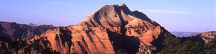
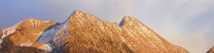
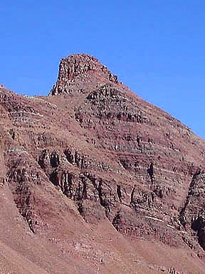
Belleview Mountain A – 13,233 feetThis colorful Elk Range Thirteener quivers between the Maroon Bells and Pyramid like the tip of a drawn arrow. |
|
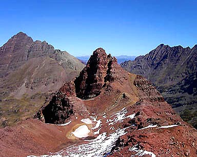 |
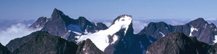
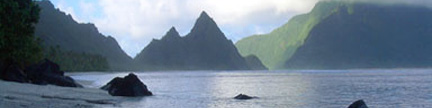
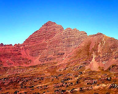
Flanked by Maroon Peak (left) and Pyramid,
Belleview provides a perfect perch in the Elk’s heartland Gerry took this photo on 9/27/03 from Point 13,210, 0.2 mile southwest of Belleview’s main summit |
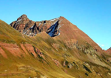 |
Belleview (left) rises above the northwest ridge, which is the easiest route to the summit Point 13,210 is in the center of the photo, and West Maroon Pass is on the far right |
 |
Jennifer descending the northwest ridge en route to Frigid Air Pass |
 |
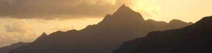
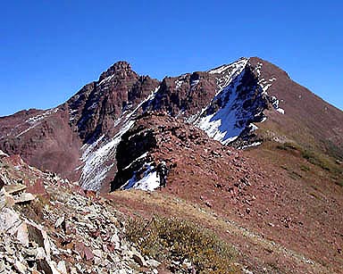
Belleview seen from West Maroon Pass, 0.6 mile south of the summit The route up the summit pyramid circles around to the right |
 |
Looking northwest from the base of Belleview’s summit pyramid From left to right the peaks are: “Siberia Peak,” Snowmass Mountain, Hagerman Peak, “North Snowmass,” Snowmass Peak, Capitol Peak, “K2,” Point 13,062 and Mount Daly |
 |
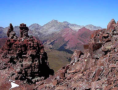
Left to right: Pyramid Peak, “Thunder Pyramid” and Point 13,722, seen from Belleview’s summit Just left of center, you can see the famous white gully, which is the standard route on “Thunder Pyramid” |
 |
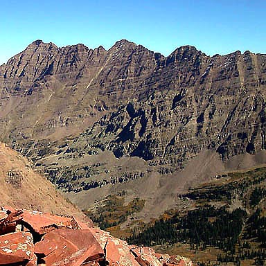
Seen from Belleview’s northwest ridge, Maroon Peak clearly states its dominance of the area Two different domains, Maroon Peak’s southwest face leaps above lush Fravert Basin |
| Gerry took the above photos on 9/27/03 | |
USGS 7.5’ Quadrangles: Maroon Bells, Snowmass Mtn.Northwest Ridge – 7.2 miles RT, 2,833 feet net, 3,133 feet total, Class 2 |
|
| This is the easiest route on Belleview Mountain. Accelerating views will draw you upward. Start at the East Fork Rock Creek Trailhead at 10,400 feet, and hike 2.6 miles northeast up Rock Creek’s east fork to a signed trail junction at 11,640 feet where the West Maroon Pass and Frigid Air Pass Trails diverge. Leave the comfort of both trails here, hike 0.4 mile directly northeast up the steep grass slope above you, dodging a large patch of bushes en route, and reach Belleview’s northwest ridge in a saddle at 12,540 feet. From here, you can gaze northeast across upper Fravert Basin at Maroon Peak. Turn southeast (right) and hike 0.4 mile up the rounded ridge to Point 13,210 where the view doubles in intensity and you can see the remaining route to Belleview’s summit pyramid. Descend 200 yards northeast to the 13,060-foot saddle between Point 13,210 and Belleview’s main summit, then circle around the south side of the summit pyramid and reach the highest point from the northeast (Class 2). Try and arrange your ascent on an immaculate day, so you can lounge here steeping in the surroundings. |
|
Southeast Ridge – 8.6 miles RT, 2,833 feet net, 3,133 feet total, Class 2+ |
|
| This is a sporting alternate route on Belleview Mountain, which offers some classic Elk Range scampering up loose ledges. Start at the East Fork Rock Creek Trailhead at 10,400 feet, and hike 2.6 miles northeast up Rock Creek’s east fork to a signed trail junction at 11,640 feet where the West Maroon Pass and Frigid Air Pass Trails diverge. Continue southeast (right) on the West Maroon Pass Trail for another 1.0 mile to 12,500-foot West Maroon Pass. As an alternate approach, you can reach West Maroon Pass by hiking 5.9 miles up the well maintained trail from the popular Maroon Lake above Aspen. Leave the trail in the pass, and pick a path northeast on or near the rocky ridge (Class 2+). If the route looks improbable, take some time to discover the scampering passages that always appear on these Elk Range rambles. Once past the ridge towers, continue up easier terrain to Point 13,210, and continue on the final portion of the Northwest Ridge Route. Ascending the Southeast Ridge Route and descending the Northwest Ridge Route makes a smart Tour de Belleview. If the day is fine, you can choose to walk the northwest ridge all the way to Frigid Air Pass just to extend your time in the high country. | |
Copyright © 2001-2023 by Gerry Roach. All Rights Reserved. |